and Chasing
[Index][Archives]
Flash Flood Storm Chase: Tuesday 2nd January 1996
by Jimmy Deguara
| Storm News and Chasing [Index][Archives] |
Flash Flood Storm Chase: Tuesday 2nd January 1996 by Jimmy Deguara |
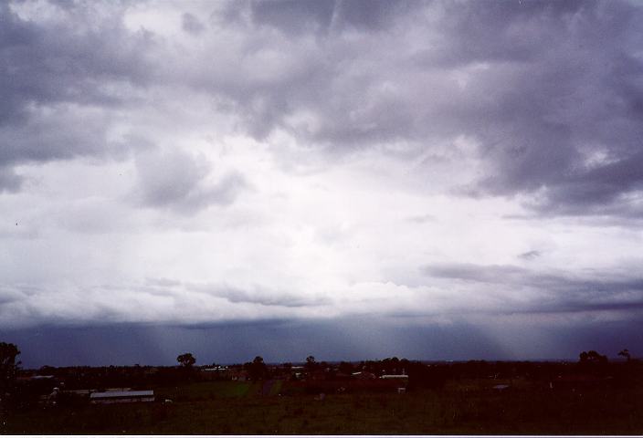
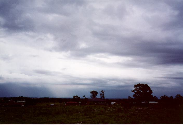
Another band developed almost overhead with heavy drops of rain heard thundering roofs a few hundred metres away. Again, this was brief but increased to heavy rain within a few kilometres of Schofields. Up to this stage, no lightning or thunder was observed. However, despite the fact it was a low contrast day, I decided to chase in order to verify whether other areas really had received heavy rain. Heavy runoff was observed from Quakers Hill onwards. However, another storm band was developing rapidly at the northwestern rear of this band and looked more organised as well as severe. Whilst travelling through Blacktown, I decided to turn towards the storm heading for Doonside. Visibility was reduced significantly once in the storm with heavy rain and strong winds. I took shelter at a local service station since there was danger of trees falling onto the road.
After taking a few photographs of creeks that were close to overflowing, I headed home.
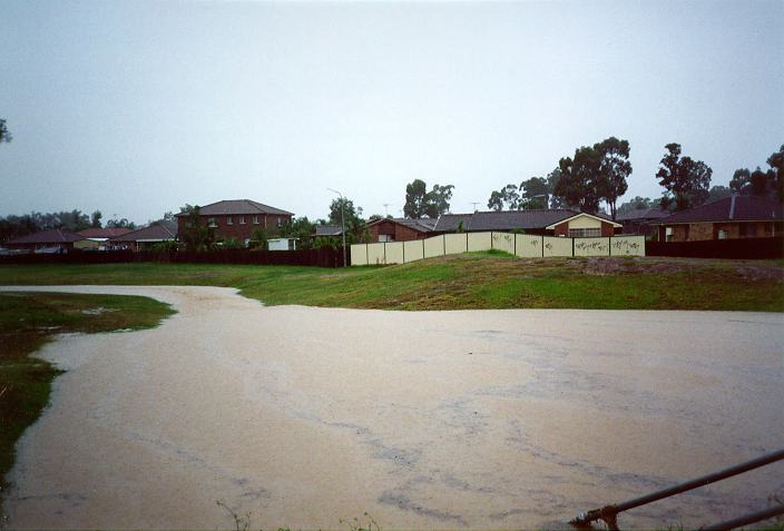
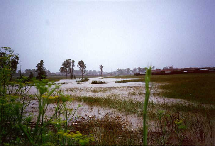
Some flash flooding near Oakhurst. Photos by Jimmy Deguara
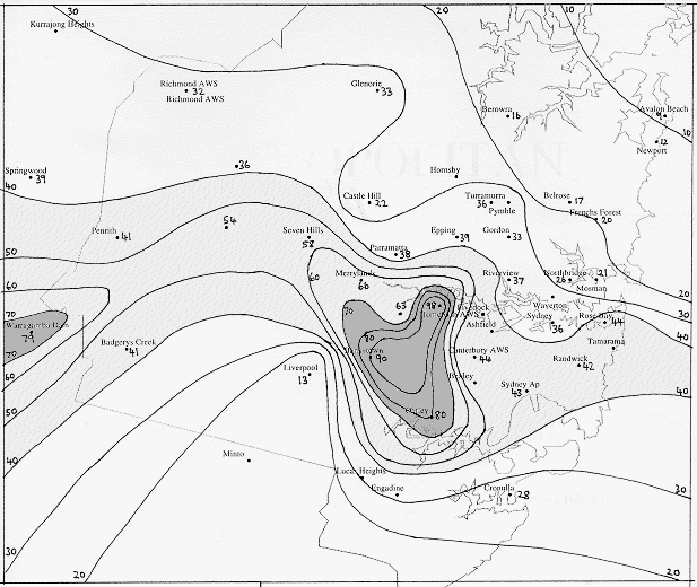
Torrential rain falling at up to 150mm/hour fell in a large area of Sydney. Flash flooding was reported in many areas, stranding mororists and flooding homes and shops. The severe storms moved in from the WNW at 1.45pm, peaking at Homebush Bay just after 2pm. Intense rainfalls recorded included 67mm in 75 minutes at Bankstown, 71mm in 58 minutes at Homebush Bay, 50mm in about an hour at Oakhurst.
The areas worst affected by the flooding were Alexandria, Bankstown, Botany, Canterbury, Georges River, Homebush, Lansvale, Lidcombe, Mascot, Milperra, Northmead, Padstow, Redfern, Revesby and Strathfield.
Click here to view the rainfall isohyet map of Sydney for the 24 hours to 9am 3rd January 1996 (by Michael Bath)
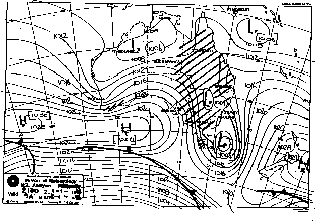
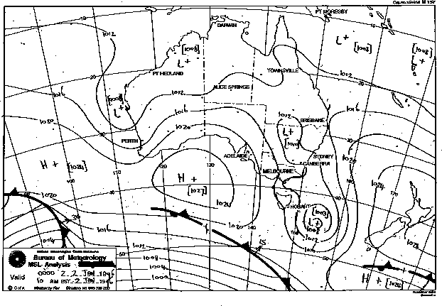
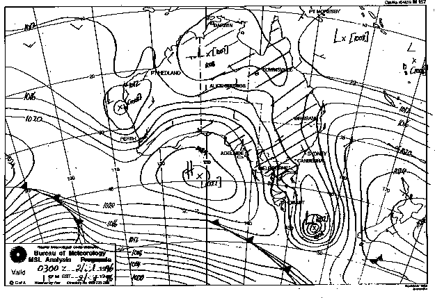
Synoptic Charts provided by the Bureau of Meteorology
|
Document: 9601-01.htm
Updated: 6th April, 2004 |
[Australian Severe Weather index] [Copyright Notice] [Email Contacts] [Search This Site] |