and Chasing
[Index][Archives]
Perth Tornado: Monday 15th July 1996
by Radek Dolecki
| Storm News and Chasing [Index][Archives] |
Perth Tornado: Monday 15th July 1996 by Radek Dolecki |
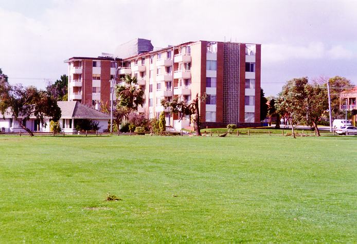
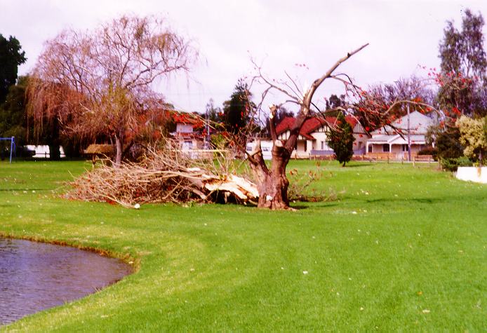
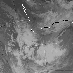
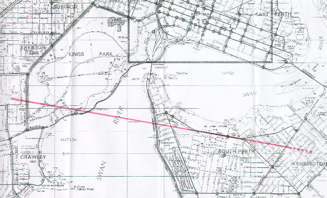
At approximately 8.30pm a squall line moved through the metropolitan area. It was accompanied by a severe thunderstorm, which spawned one tornado in suburban Perth. The tornado touched down at Sir Charles Gairdner Hospital in Shenton Park. There it caused some structural damage to the hospital, and brought down a large number of trees which totally blocked the ambulance access to the hospital. The tornado then moved through Kings Park where it caused extensive damage to vegetation. Trees in it's path were either defoliated, uprooted, or had their crowns snapped off.
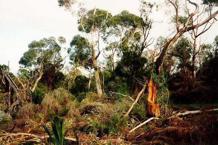
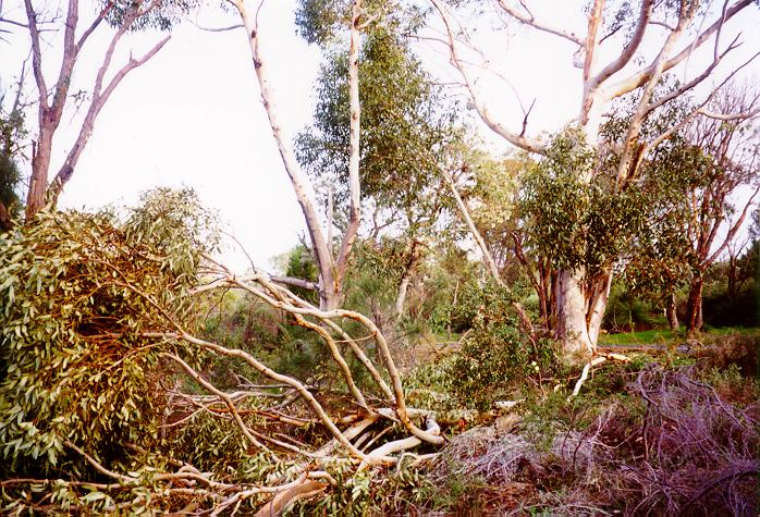
Tree damage at Kings Park.
After exiting Kings Park the tornado crossed Swan River and entered the suburb of South Perth, where it caused extensive damage to both houses and vegetation, before finally lifting somewhere in the suburb of Kensington.
Click here to view a map showing the tornado path
The most extensive damage caused by the tornado occurred in South Perth. Residences along Mill Point Road were hardest hit, with numerous houses losing their roof tiles, and at least two losing their entire roofs.
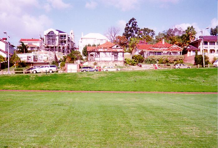
Three houses damaged on Mill Point Road, South Perth.
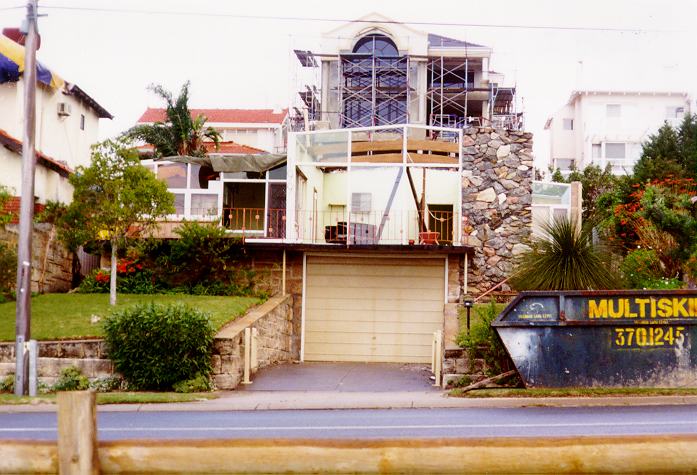
The most damaged house, Mill Point Road, South Perth.
A block of flats directly in the tornados path had it's roof peeled off, parts of which were carried some 300 meters to be deposited in a car park.
Block of flats on Mill Point Road, South Perth, damaged by the tornado.
There were several reports of roofs being removed and deposited some distance away. In all more than 30 houses were damaged, 10 seriously, with two almost completely destroyed. Other notable damage in South Perth included uprooted and snapped trees, downed power lines, snapped power poles, and flattened fences and brick walls.
Tree damage in South Perth.
The thunderstorm that spawned this tornado was not a supercell. I was informed by the Weather Bureau that no mesocyclones were evident on the radar, and there was really nothing there to indicate the storm's severity or the presence of a tornado. A very intense updraught was obviously present, but at the same time it was very short lived. This was indicated by the tornado's speed (approx. 80 km/h) and path (approx. 4 km long and 40m wide) which gave it a total time on earth of approx. only 3 minutes. Based on it's speed the Weather Bureau estimated that the tornado began forming somewhere over Rottnest Island.
The Weather Bureau indicated that based on the bulk of the damage it caused, the tornado was most likely an F0 tornado (perhaps a weak F1). This was indicated by the bulk of roof damage being limited to tile damage. It is therefore interesting to examine the house on Mill Point Road shown above, which had it's entire roof ripped off and deposited in the neighbouring property's backyard, while those around it also directly in the tornado's path suffered damage to tiles only.
The critical factor here is that this house had a flat roof while those around it did not (see photo above). I was told by the Weather Bureau that research in America has shown that it is much easier for tornados to remove flat roofs than skewed ones. Hence the stark difference in damage caused to the afore mentioned houses on Mill Point Road in South Perth. When the tornado hit the house with the flat roof, it caused all windows to blow out, and the pressure that was consequently built up inside the house was sufficient to lift the roof. The tornado was not strong enough to do this to houses with skewed roofs, and only tiles were removed by the strong winds. I also observed that multi-storey residences in the tornado's path seemed to suffer greater damage than single level houses. However, I do not have an explanation for that.
Because the event occurred under cover of night, no footage or photographs of the tornado itself were taken. It is clear however that the tornado definitely did have a visible funnel, as at least one nurse at Sir Charles Gairdner Hospital reported seeing one move through the well lit up car park.
Tornados such as this are not uncommon in the South West of Australia during the winter months. While these events are rare in the metropolitan area, it is actually the second tornadic event we have had in the metro area this season. The first was a 'cock eyed bob' which moved through Dianella earlier in the season, damaging the roof of a petrol station and defoliating many trees. However, the latest tornado was much stronger, and is probably the strongest tornado to hit the Perth area since a strong tornado demolished houses in a Mandurah suburb some two or three years ago.
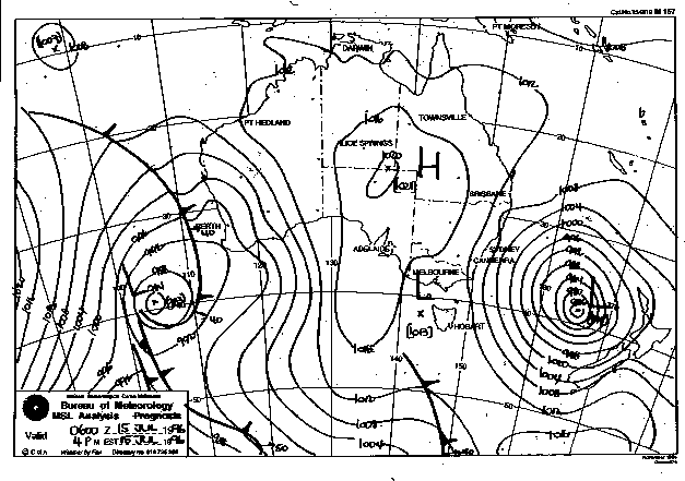
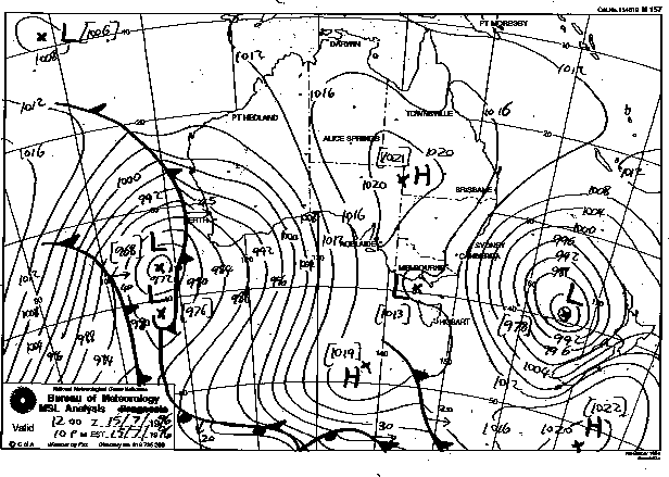
Synoptic Charts provided by the Bureau of Meteorology
|
Document: 9607-02.htm
Updated: 6th April, 2004 |
[Australian Severe Weather index] [Copyright Notice] [Email Contacts] [Search This Site] |