and Chasing
[Index][Archives]
Western Sydney Storm Chase: Saturday 7th December 1996
by Michael Bath
| Storm News and Chasing [Index][Archives] |
Western Sydney Storm Chase: Saturday 7th December 1996 by Michael Bath |
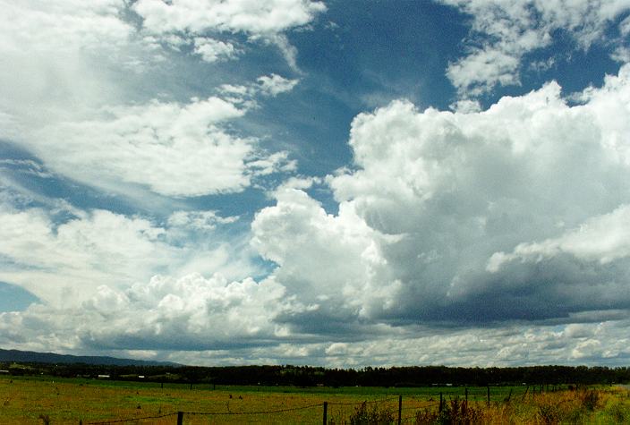
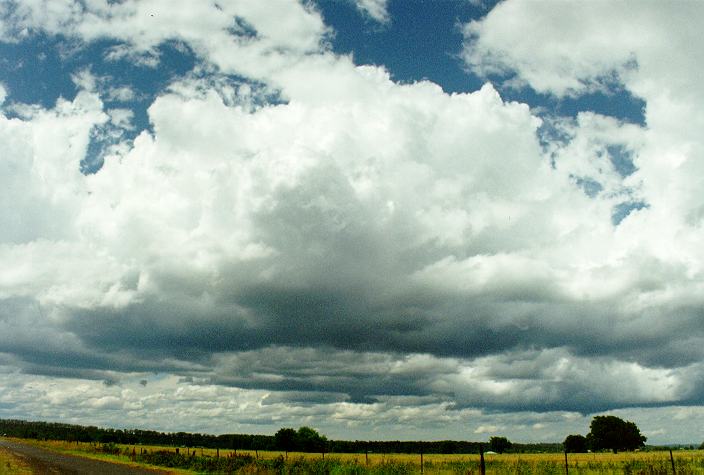
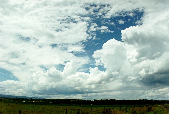
Rain ceased before dawn leaving overcast, very warm and very humid conditions with light winds. Thick middle level cloud started to break down by late morning, by which time I was keeping a close watch on potential development to the west. I didn't have to wait long - cumulus followed by cumulus congestus developed after some brief sunny breaks.
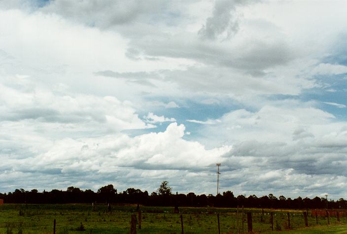
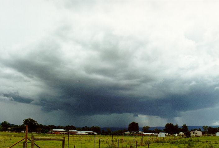
I headed out towards Richmond as soon as the congestus was observed, as it was located on the eastern part of the Blue Mountains, which often move quickly into the metropolitan area. After just 15 minutes of driving a storm cell had developed and was heading north-east. I stopped briefly at South Creek to get a better look. By 1.25pm I reached a vantage point at East Richmond. The storm was now quite large and bearing down on the area from the south-west, although lightning was infrequent. An interesting feature as the storm approached was a line of development extending eastwards into the metropolitan area from the main cell. This took on the appearance of a roll or shelf cloud separating a spectacular rain shaft to the south-east. The intense column of precipitation started to look like a funnel cloud for a while!
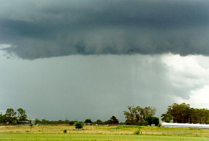
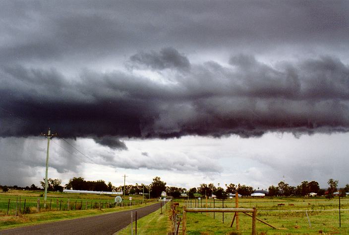
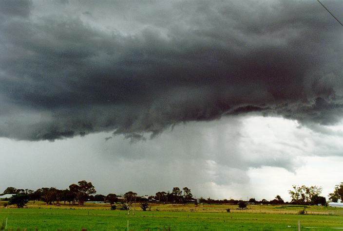
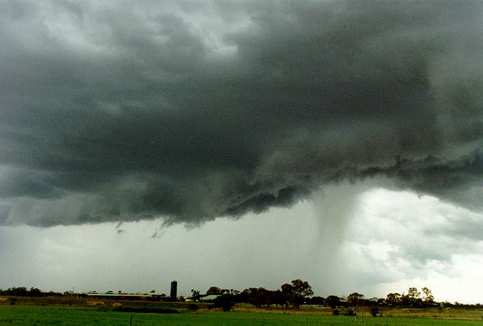
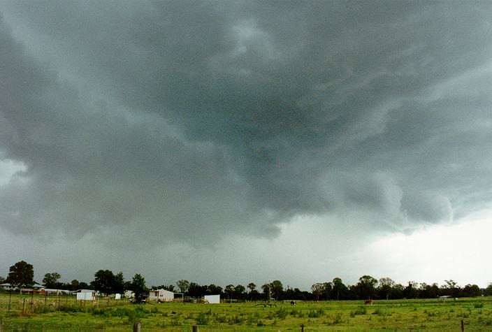
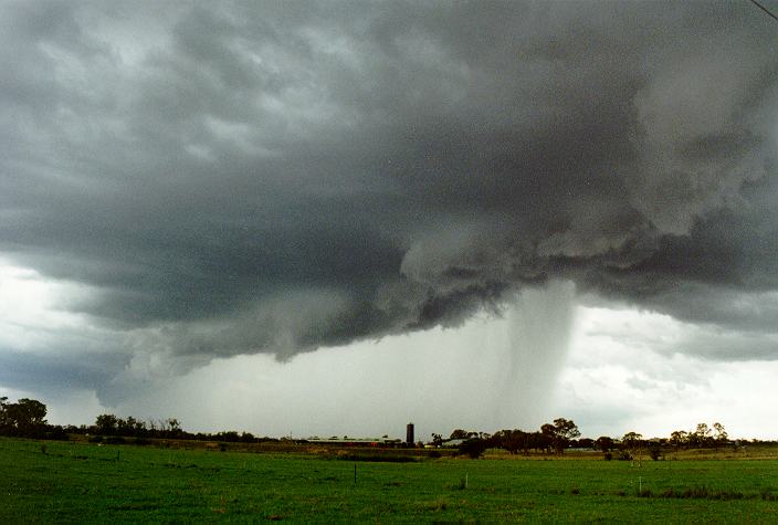
The main storm to the south-west grew larger and larger and developed a shelf cloud and green tinge - not a great sign as it was coming directly towards me. I stayed as long as I dared to capture the interesting cloud features, then made a dash for town as the first large raindrops fell. I made it to a service station just as the rain became intense. For about 10 minutes it bucketed down, although I observed no hail. Streets soon became awash with drains unable to cope. I left the service station as it was still pouring, negotiating through some very wet roads, avoiding the flooded streets. The time was 2.10pm. I headed north-east following the cell to find any signs of hail, but none were observed.
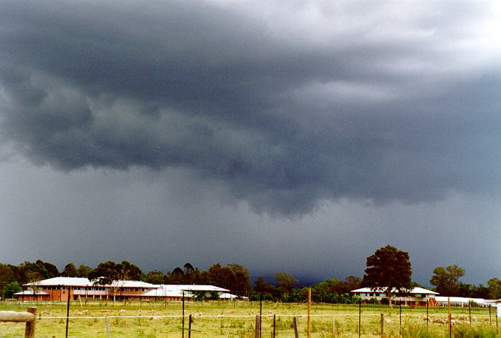
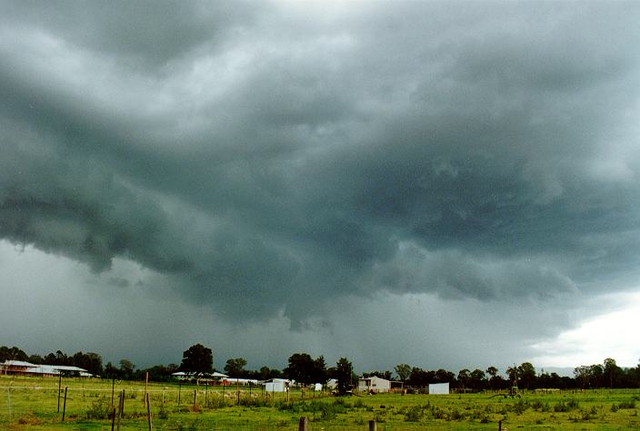
A spectacular band of congestus in a flanking line extended to the foot of the mountains from the storm. I moved to the north Richmond area to observe this. It was otherwise mostly sunny, with hot and humid conditions. There was also some congestus on the mountains, but at least 50km away, and this dissipated as the afternoon wore on.
Cloud again built up, but this time over metropolitan areas, particularly the south and south-western suburbs. A southerly change was moving into the region and some convergence resulted in more large cumulus and some small storm cells. Showers with isolated flash flooding occurred in various locations, particularly Sylvania, Manly, Queenscliff and Granville.
Cool southerly winds developed throughout by 4.30pm, soon followed by stratocumulus.
|
Document: 9612-04.htm
Updated: 7th April, 2004 |
[Australian Severe Weather index] [Copyright Notice] [Email Contacts] [Search This Site] |