and Chasing
[Index][Archives]
Schofields Hailstorm: Saturday 20th September 1997
by Jimmy Deguara
| Storm News and Chasing [Index][Archives] |
Schofields Hailstorm: Saturday 20th September 1997 by Jimmy Deguara |
Around late morning, I noticed the persistent band just to the north becoming more organised with crisp tops. Simultaneously, to the west and along the line of this band, a weak looking storm was developing. Having things to do, I went inside not expecting much more to happen within the immediate future. But after being called outside to see the 'spectacular cloud', I was amazed to observe the band of cumulus several kilometres to the north had developing precipitation cascades: one isolated minor cell indicating the base structure associated with hail. The anvil from the thunderstorm to the west had moved over this band of cumulus. At noon, the first cloud to ground lightning was observed followed by thunder. Michael called soon after to see what was going on as he has little view to his north. My decision was to keep watch and keep in touch.
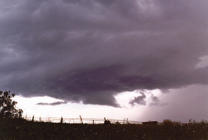
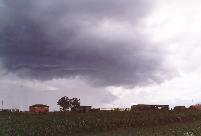
It was after the phone call that the sky seemed to explode with activity. The storm to the west had moved further east with precipitation now on the edge of the escarpment of the Blue Mountains around Kurrajong to the northwest. All cells were rapidly intensifying indicating the structure of hail. Due to the multicellular development, the overall movement was east to southeast. An arcus cloud (dark turbulent looking cloud base below the main cloud level adjacent to a precipitation cascade) developed at the rear of the Kurrajong precipitation cascade. It looked as though it would miss our area and head towards the Windsor area so I decided to quickly call Michael for a storm chase. Michael was not able to make it for at least half an hour so I decided to get as many photographs as possible. 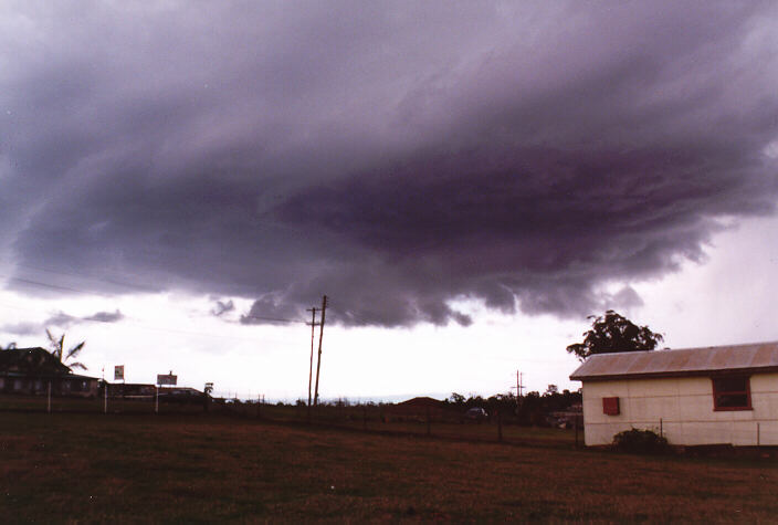 Large drops began falling but I still persisted in taking photographs of the arcus cloud. It was by 12.30pm that I realised "It's heading our way!". This created a sudden adrenaline rush.
 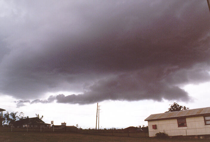 The feeling of not having to chase because the action was heading our way was overwhelming. A faint precipitation cascade had already begun falling from the rear of the arcus cloud which increased hopes we would not miss out. What I did not realise was that if the arcus cloud came straight over, little precipitation would fall unless the cloud burst. I took several other photographs and repositioned myself near the house protected from the large drops of rain.
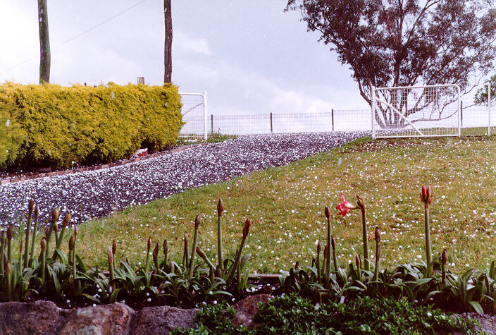
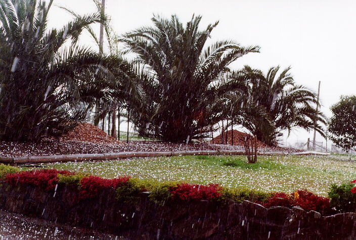
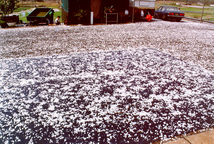
Around 12:55 pm, I observed precipitation falling further down the road moving slowly our way. Large drops began to fall. The noise from 'precipitation' thundering down on the roofs in neighbouring properties became more audible. And no wonder!! It was hail - up to 2 cm in diameter. By this time, my friend Jeff had arrived and he quickly put his car under cover. 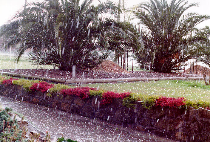 (Jeff has been unlucky with 3 previous cars damaged by hail. This could have been his fourth). The hail bounced at least half a metre above the ground. The hail fell so profusely that within a minute or so, it lay like a thin blanket on the ground although not completely covering the ground. The hail dominated with some heavy rain. It only lasted 5 minutes. It continued to move southeast.
Jeff and I decided to inspect the farm to see if larger hail had fallen in that area. The further down the farm we walked the hail seemed to be on average slightly larger but still a maximum diameter of around 2 cm.
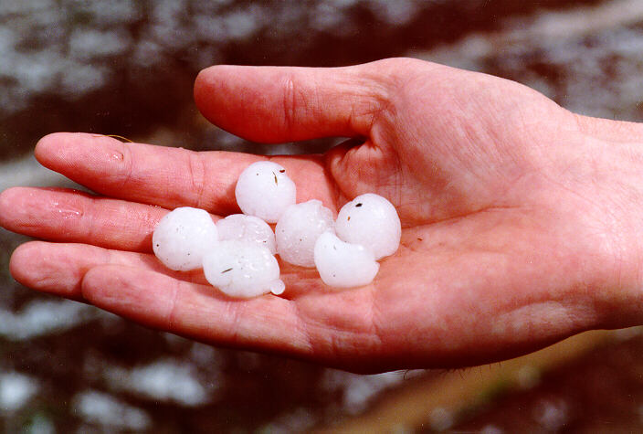 As we walked down, I took photographs of hail on Geoff's hand for comparison of size although we found some slightly large ones later.
Another thunderstorm which had developed to the southwest was moving towards the Oakhurst to Blacktown area and gradually edging towards Quakers Hill. After taking photographs of this storm system, my attention turned towards another arcus cloud developing at the rear of this storm system to our west. A thin isolated precipitation cascade also developed from the rear of this arcus cloud. 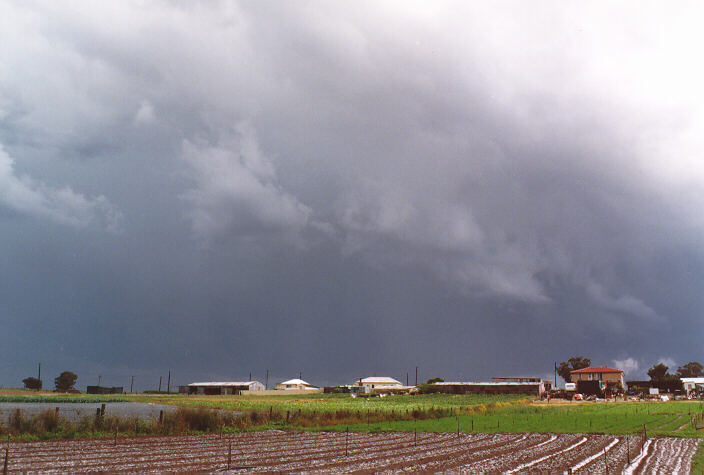
 It was also heading our way so after inspecting the hail and damage to the crops of spinach, we headed back for cover. At around 1:30 pm, we observed the precipitation cascade (which had intensified) approaching with the arcus cloud passing overhead. At 1:36 pm, large drops was followed by a downpour. Soon after, a strong gust of wind hit. The rain hammering the corrugated iron roof was so loud, we could not hear each other speak.
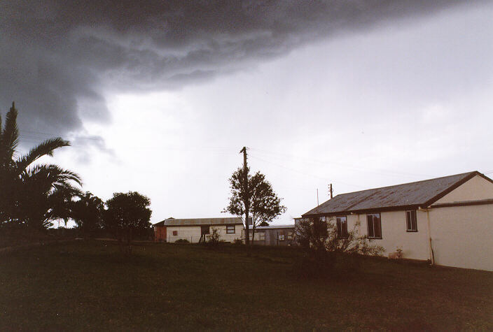
 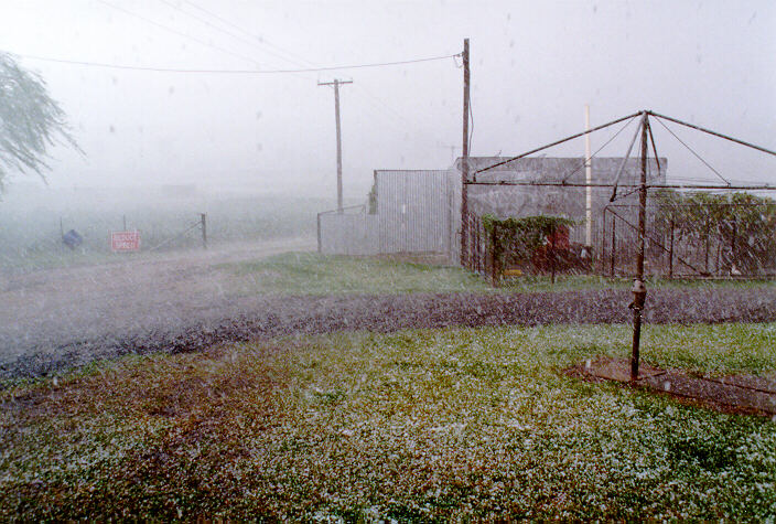 Tiny hail also accompanied the heavy rain. This deluge lasted at most four minutes and probably totaled 8-9 mm of rain. This was the last of the action. Basically, the storm bands moved to the east and southeast with isolated showers later.
This storm produced the largest hail in Schofields since 29th September 1983. That storm produced larger hail (3 -4 cm in diameter) and damaged windows and crops. Crops were also damaged in this storm but only minor dents to aluminium surfaces was observed. The hail may have caused damaged to cars had wind accompanied the hail. There were reports of hail denting cars in the Parklea to Kellyville area. Another report verified a smashed windscreen. It was one very interesting thunderstorm and an unusally good start to the storm season.
Another interesting coincidence occurring that day was the fact that the Nylex 1000 professional rain gauge that I had erected and used for over 10 years was dismantled that morning! It certainly would have been damaged by the hail.
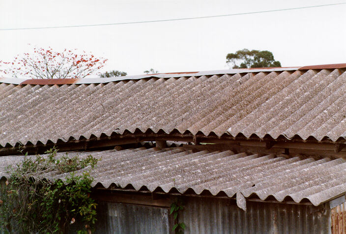
You may be wondering what the hell is so special about this roof?? If you click this image, you will notice spot marks on the roof where the mould and dirt has been cleaned by hailstones splattering as they hit the roof. Could you imagine just what would happen to this roof with giant hailstones!!
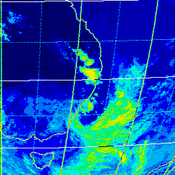
These images obtained from James Cook University
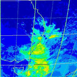
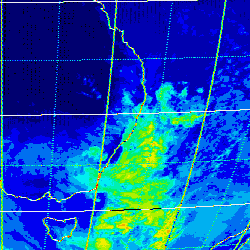
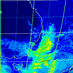
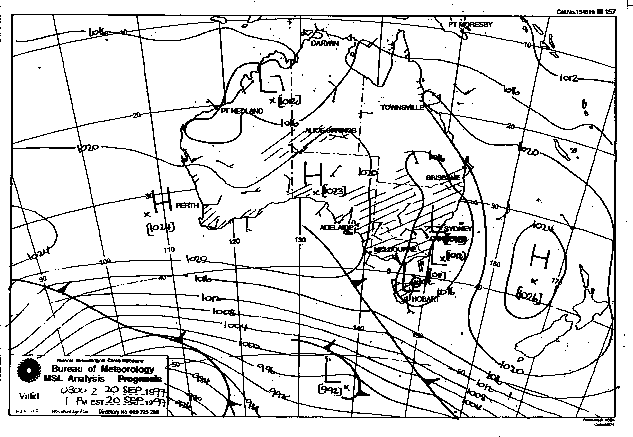
This image obtained from the Bureau of Meteorology
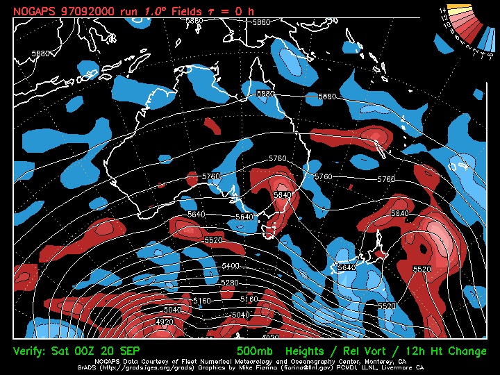
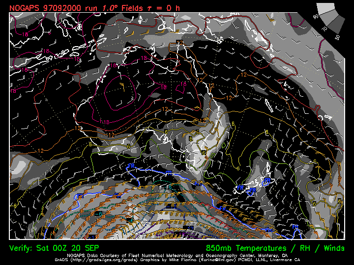
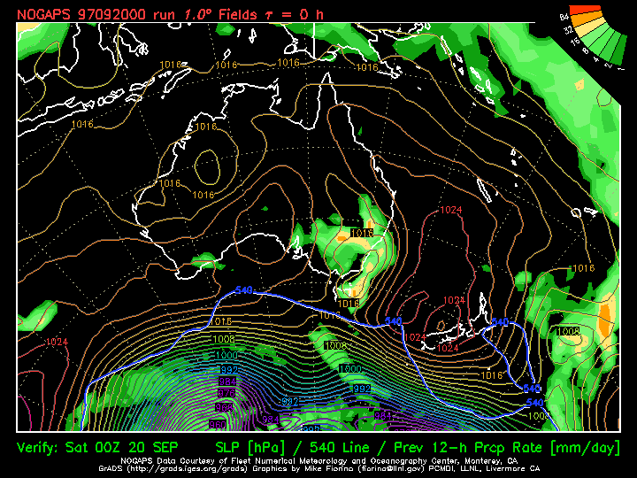
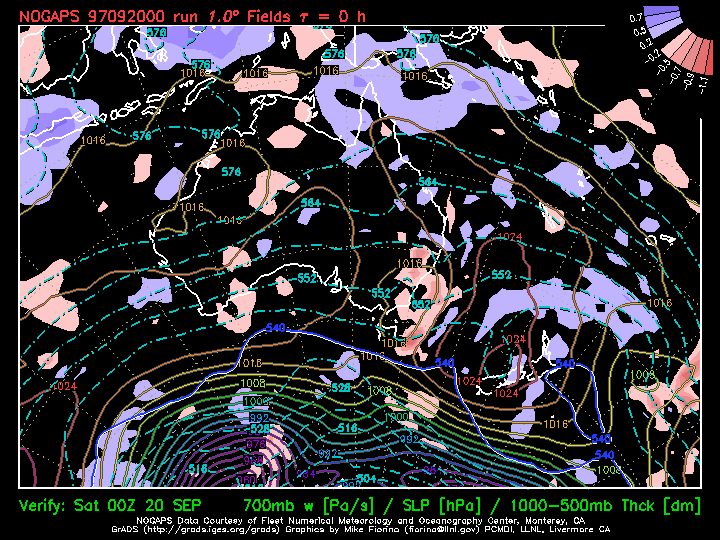
These charts obtained from US Navy's NOGAPS models
|
Document: 9709-01.htm
Updated: 5th May, 2005 |
[Australian Severe Weather index] [Copyright Notice] [Email Contacts] [Search This Site] |