and Chasing
[Index][Archives]
Bushfires Fuel Pyro-cumulonimbus on NSW North Coast: Saturday 22nd December 2001
by Dave Ellem. Additional photos by Michael Bath
| Storm News and Chasing [Index][Archives] |
Bushfires Fuel Pyro-cumulonimbus on NSW North Coast: Saturday 22nd December 2001 by Dave Ellem. Additional photos by Michael Bath |
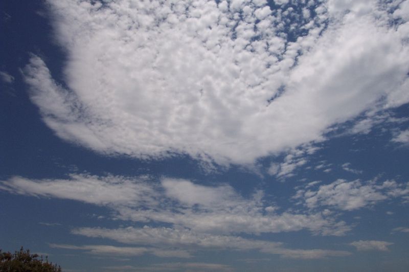 The
forecast was for a hot day of around 39C with afternoon thunderstorms with hail
and squally winds. The day started as many storm days do with a nice moisture
haze and a sky filled with altocumulus and altocumulus castellanus. This persisted
well into the afternoon. After watching stuff develop south of my place visually
I gave Michael the call to let him know what I could see and so we decided to
head out. After picking me up we headed towards Woodburn. A rather nice cell had
developed to the south and a line of congestus extended to the NW from this cell
well into the Border Ranges. As we drove new towers were extending up behind the
main cell and were capped with pileus. This continued for a while. The cells seemed
fairly high based and weren't all that high topped.
The
forecast was for a hot day of around 39C with afternoon thunderstorms with hail
and squally winds. The day started as many storm days do with a nice moisture
haze and a sky filled with altocumulus and altocumulus castellanus. This persisted
well into the afternoon. After watching stuff develop south of my place visually
I gave Michael the call to let him know what I could see and so we decided to
head out. After picking me up we headed towards Woodburn. A rather nice cell had
developed to the south and a line of congestus extended to the NW from this cell
well into the Border Ranges. As we drove new towers were extending up behind the
main cell and were capped with pileus. This continued for a while. The cells seemed
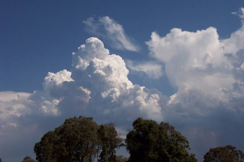
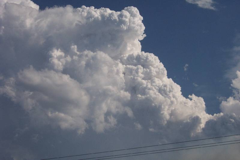
fairly high based and weren't all that high topped. 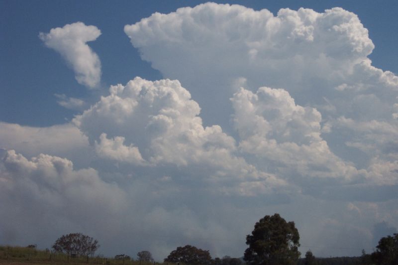 In front of this cell there was a bushfire that had started in the Bundjalung
National Park. Pyrocumulus (pyrocu) was developing above this but not all that
much. The first cell seemed to be heading more easterly than the ENE direction
that we believed most storms would move today. As this one seemed to move away
another more
In front of this cell there was a bushfire that had started in the Bundjalung
National Park. Pyrocumulus (pyrocu) was developing above this but not all that
much. The first cell seemed to be heading more easterly than the ENE direction
that we believed most storms would move today. As this one seemed to move away
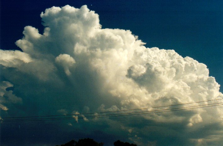
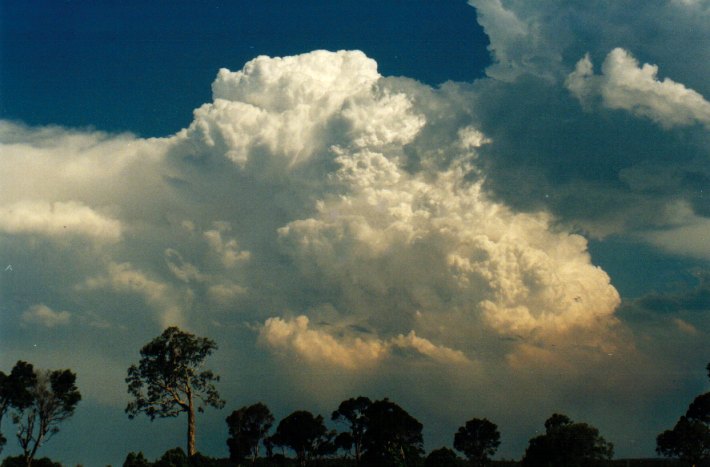
another more 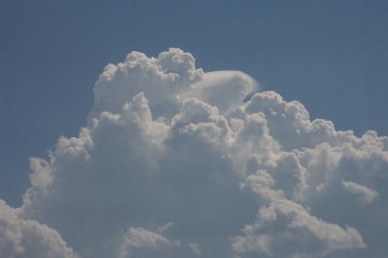 impressive congestus cloud got going and developed another pileus cap. By
this stage we had arrived at Woodburn. Although looking promising this cell just
couldn't get it together. However as it moved over the bushfire it seemed to take
on a pryo-cumulonimbus (pyroCb) appearance and so took off a little more. It still
didn't seem to produce a proper anvil and wasn't high topped. We had met up with
Rodney at this stage and found a tree to park under to try and shade us from the
horrible heat with was approaching the 40C mark! The line of congestus that was
extending to the NW seemed to just stay fairly small until it moved over the fires
and got a little larger. We had reports of thunder from people at Evans Head on
the CB Radio. Out to the west we noticed the anvils of some thunderstorms on the
ranges.
impressive congestus cloud got going and developed another pileus cap. By
this stage we had arrived at Woodburn. Although looking promising this cell just
couldn't get it together. However as it moved over the bushfire it seemed to take
on a pryo-cumulonimbus (pyroCb) appearance and so took off a little more. It still
didn't seem to produce a proper anvil and wasn't high topped. We had met up with
Rodney at this stage and found a tree to park under to try and shade us from the
horrible heat with was approaching the 40C mark! The line of congestus that was
extending to the NW seemed to just stay fairly small until it moved over the fires
and got a little larger. We had reports of thunder from people at Evans Head on
the CB Radio. Out to the west we noticed the anvils of some thunderstorms on the
ranges.
 These were to be the ones that came through later in the day. Also on the radio
we were hearing of the bushfire beginning to blaze out of control. From where
we were we could certainly see this. The line of fire seemed to be extending to
the west quite rapidly. Evacuations were beginning in camping ground at Jerusalem
Creek. We saw a number of vehicles with trailers and caravans taking all their
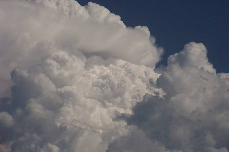
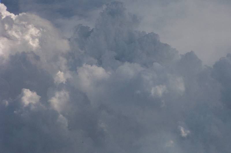
gear out of the area. It was now that the small cells began to take on an explosive
appearance. Awesome boiling updrafts shot out of the smoke haze and billowed upwards,
but still not reaching all that high. It didn't matter that these storms weren't
really fully developing because the sight of the pyroCb updrafts was just excellent!!!
These were to be the ones that came through later in the day. Also on the radio
we were hearing of the bushfire beginning to blaze out of control. From where
we were we could certainly see this. The line of fire seemed to be extending to
the west quite rapidly. Evacuations were beginning in camping ground at Jerusalem
Creek. We saw a number of vehicles with trailers and caravans taking all their
gear out of the area. It was now that the small cells began to take on an explosive
appearance. Awesome boiling updrafts shot out of the smoke haze and billowed upwards,
but still not reaching all that high. It didn't matter that these storms weren't
really fully developing because the sight of the pyroCb updrafts was just excellent!!!
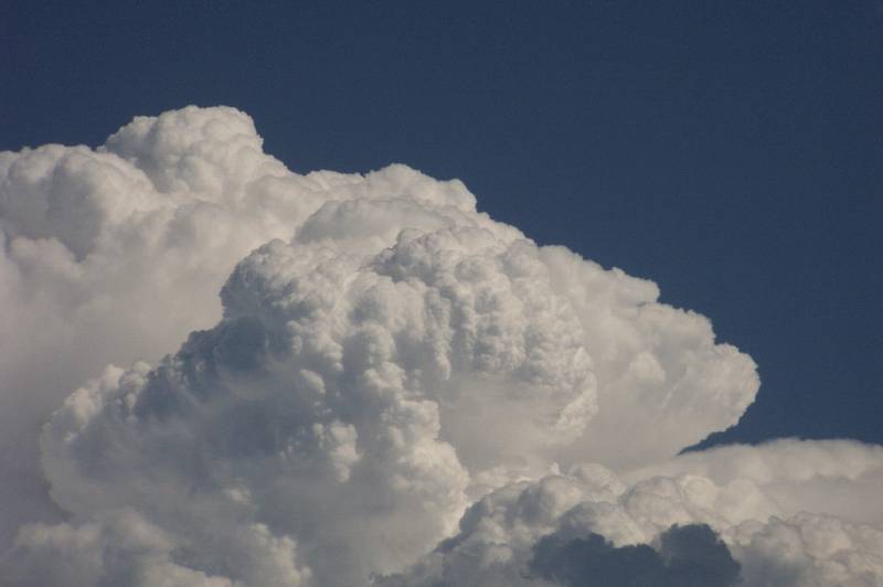
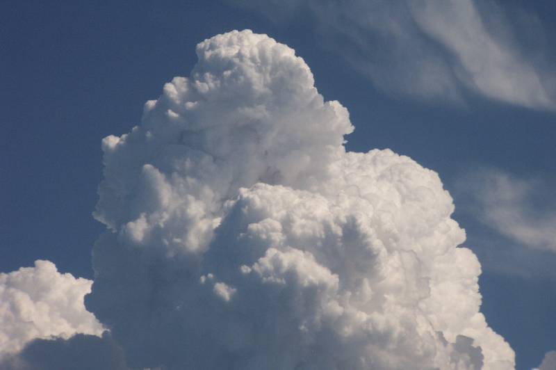
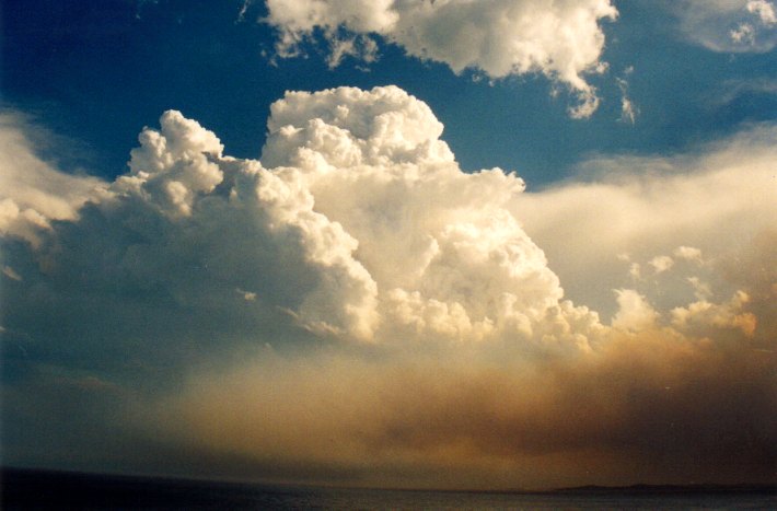
 We sat and watched these updrafts explode taking numerous shots of the pyro clouds.
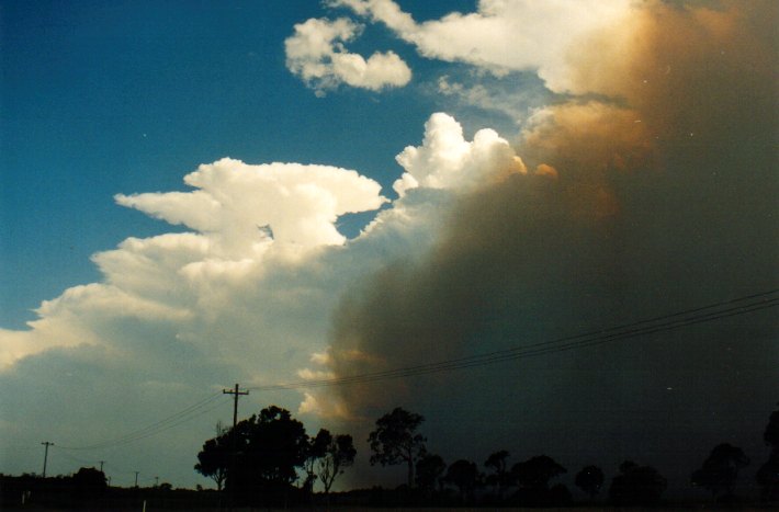
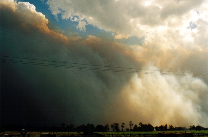
Then all of a sudden, the fire that had extended along a west of us began
to move N towards us!! The wall of smoke was getting higher and much more ominous.
PyroCbs continued to sit on top of the wall of smoke and the contrast looked great.
The wall of smoke though was rapidly approaching us. We got word over the radio
that the Pacific Hwy had been closed just south of us due to the fire. We watched
in awe and excitement until the last minute when the wall of smoke overtook us
blocking our view of the cells. We jumped in our cars and were off!! We headed
back into Woodburn and headed north hoping to get to a lookout just north of Evans
Head.
We sat and watched these updrafts explode taking numerous shots of the pyro clouds.
Then all of a sudden, the fire that had extended along a west of us began
to move N towards us!! The wall of smoke was getting higher and much more ominous.
PyroCbs continued to sit on top of the wall of smoke and the contrast looked great.
The wall of smoke though was rapidly approaching us. We got word over the radio
that the Pacific Hwy had been closed just south of us due to the fire. We watched
in awe and excitement until the last minute when the wall of smoke overtook us
blocking our view of the cells. We jumped in our cars and were off!! We headed
back into Woodburn and headed north hoping to get to a lookout just north of Evans
Head.
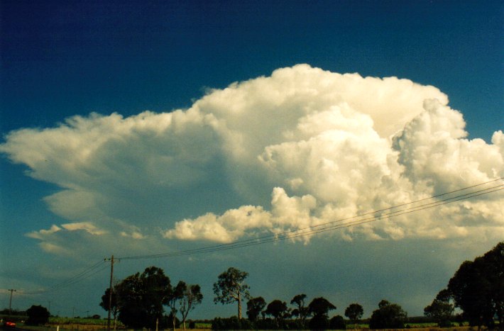
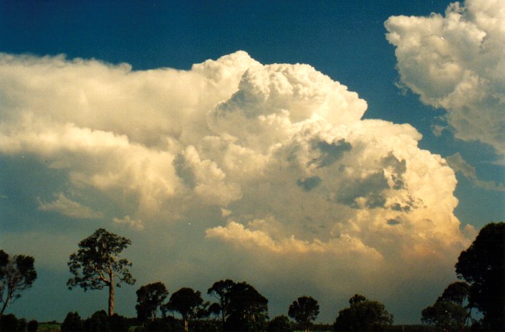
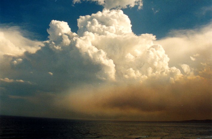
As we were driving
amazing PyroCb's shot up in the sky to the south of us!!! I was trying to get
a shot of them whilst driving 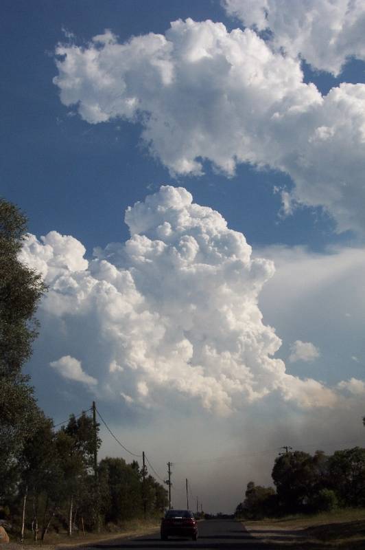 through the back window with my digi. Unfortunately when they came into view as
we headed south briefly to get to the lookout it didn't look quite as impressive.
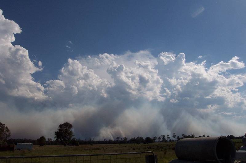
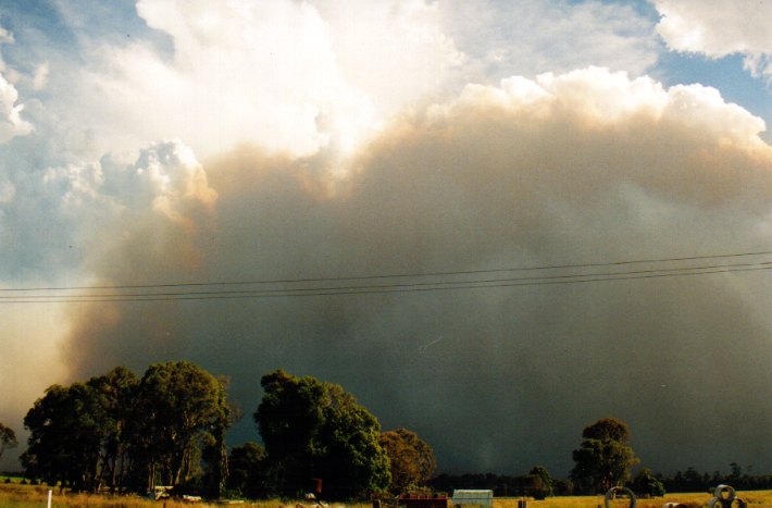
All the same when we got to the lookout we raced out of our cars with all the
gear to capture the view to the south!! A rather large PyroCb had developed fuelled
by the now large bushfires. The smoke haze was very clear underneath it extending
inland from right out over the ocean. At this time the southerly changed went
through the Evans Hd AWS and was the reason why the smoke had suddenly charged
towards us earlier. While watching it we noticed the sea breeze fighting the scorching
NW. There were heat ripples everywhere it was that hot (usually a phenomenon seen
only over tar roads on hot days). The sea breeze felt like a fridge door opening
when it pushed over us but it wouldn't last long before the NW pushed it back.
We got word that on the radar storms were heading in an easterly direction towards
Casino. So we jumped back in the car and headed for the lookout at Tregeagle.
The thick smoke haze was still on our tail all the way back towards Tregeagle.
We could see the darkening sky to the west of us and the anvil of the storm stretched
overhead. We could still see the PyroCb over the ocean behind us as we travelled,
still looking impressive.
through the back window with my digi. Unfortunately when they came into view as
we headed south briefly to get to the lookout it didn't look quite as impressive.
All the same when we got to the lookout we raced out of our cars with all the
gear to capture the view to the south!! A rather large PyroCb had developed fuelled
by the now large bushfires. The smoke haze was very clear underneath it extending
inland from right out over the ocean. At this time the southerly changed went
through the Evans Hd AWS and was the reason why the smoke had suddenly charged
towards us earlier. While watching it we noticed the sea breeze fighting the scorching
NW. There were heat ripples everywhere it was that hot (usually a phenomenon seen
only over tar roads on hot days). The sea breeze felt like a fridge door opening
when it pushed over us but it wouldn't last long before the NW pushed it back.
We got word that on the radar storms were heading in an easterly direction towards
Casino. So we jumped back in the car and headed for the lookout at Tregeagle.
The thick smoke haze was still on our tail all the way back towards Tregeagle.
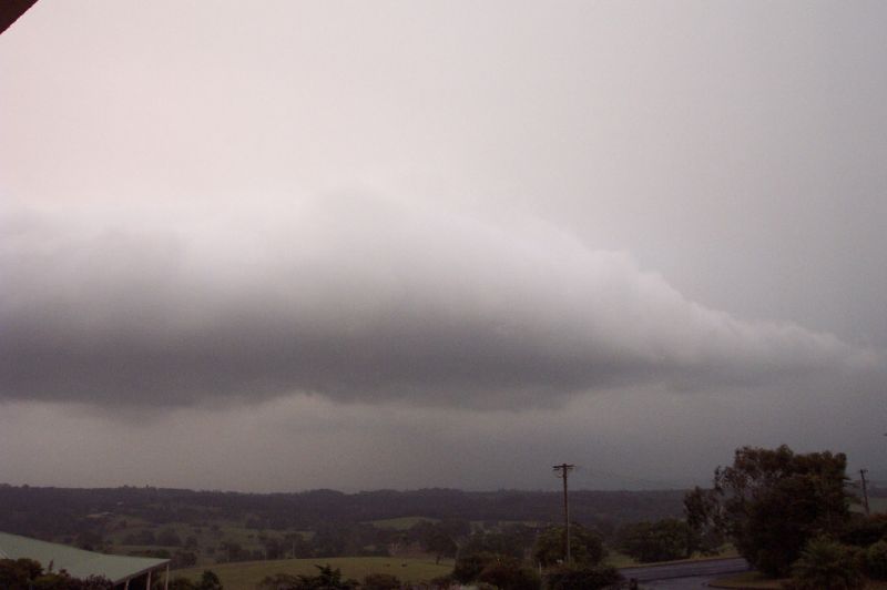
We could see the darkening sky to the west of us and the anvil of the storm stretched
overhead. We could still see the PyroCb over the ocean behind us as we travelled,
still looking impressive.
 Much to our disappointment, just as we reached the lookout at Tregeagle the smoke
haze overtook us and was so thick we couldn't see the storm anymore. So there
was no point hanging around and we headed back home to wait for the storm to pass
over us. Just as Michael dropped me home the smoke haze blew over my home and
blocked my view of the coming storm. So I was only going to be able to watch this
storm on radar.
Much to our disappointment, just as we reached the lookout at Tregeagle the smoke
haze overtook us and was so thick we couldn't see the storm anymore. So there
was no point hanging around and we headed back home to wait for the storm to pass
over us. Just as Michael dropped me home the smoke haze blew over my home and
blocked my view of the coming storm. So I was only going to be able to watch this
storm on radar.
 There were a few cells in the area. One passed south of my place and hit near
Ballina. The other was located NW of my house but was heading in an easterly direction.
However the storm developed on it's southern side into a big blob of red on radar
and was aligned with my place. Both Michael and I looked set to be hammered by
this storm. However just as the storm went through Lismore it split, the one aligned
with us heading in a SE direction, the other continuing east, and so managed to
split right around both our homes!!! We barely got any rain or winds however a
guster did make an appearance through the smoke haze as the storms passed.
There were a few cells in the area. One passed south of my place and hit near
Ballina. The other was located NW of my house but was heading in an easterly direction.
However the storm developed on it's southern side into a big blob of red on radar
and was aligned with my place. Both Michael and I looked set to be hammered by
this storm. However just as the storm went through Lismore it split, the one aligned
with us heading in a SE direction, the other continuing east, and so managed to
split right around both our homes!!! We barely got any rain or winds however a
guster did make an appearance through the smoke haze as the storms passed.
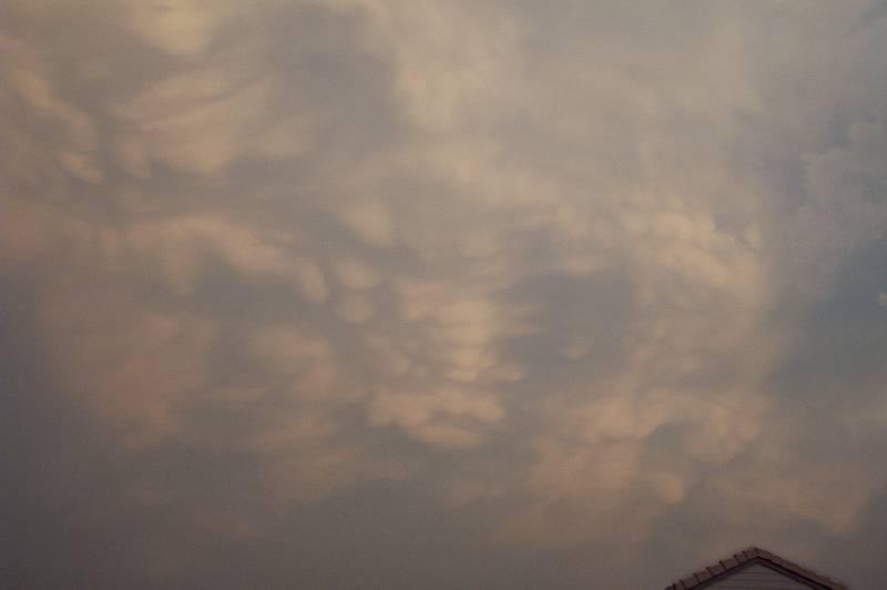
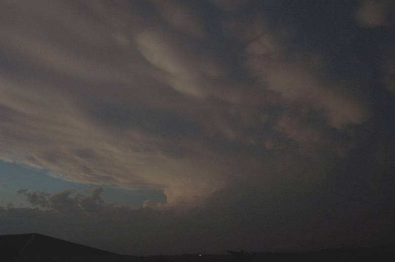
 The storm seemed to clear out a lot of the smoke haze and as the storm moved off
the coast the sky was filled with mammatus!!! It was the best looking mammatus
display I had seen. Another storm had developed in Qld to the north of us and
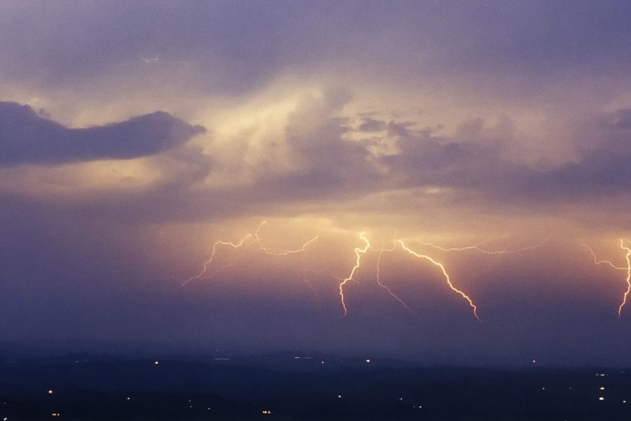
after sunset gave a huge backsheared anvil with mammatus. We were then treated
to great lightning display! Later on that night I got a report of golf ball sized
hail on the southern side of Alstonville, where the large storm with the big red
blob on radar moved over. Not a great deal of damage occurred though. A thoroughly
enjoyed chase day with many exciting elements of the weather witnessed!!
The storm seemed to clear out a lot of the smoke haze and as the storm moved off
the coast the sky was filled with mammatus!!! It was the best looking mammatus
display I had seen. Another storm had developed in Qld to the north of us and
after sunset gave a huge backsheared anvil with mammatus. We were then treated
to great lightning display! Later on that night I got a report of golf ball sized
hail on the southern side of Alstonville, where the large storm with the big red
blob on radar moved over. Not a great deal of damage occurred though. A thoroughly
enjoyed chase day with many exciting elements of the weather witnessed!!
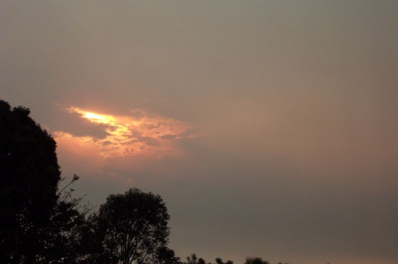
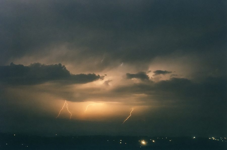
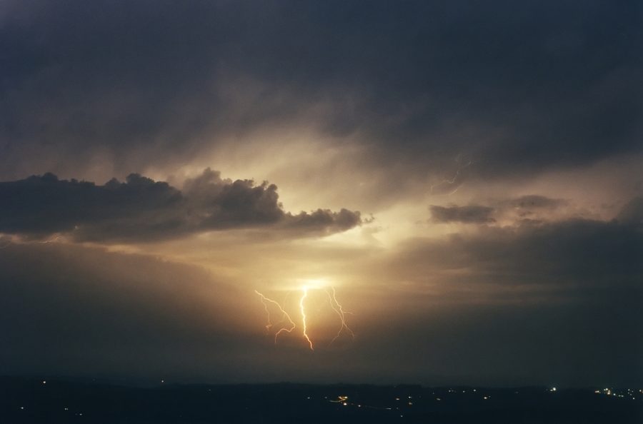
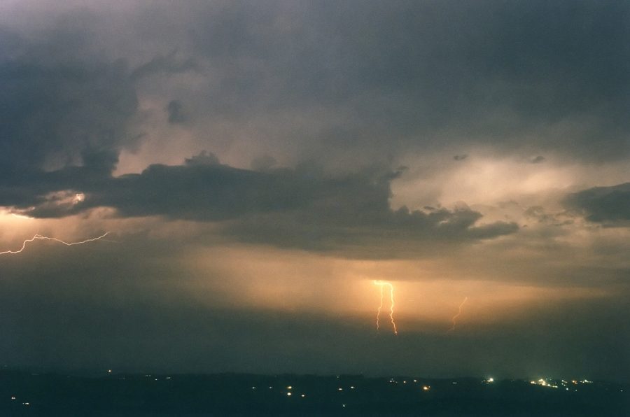
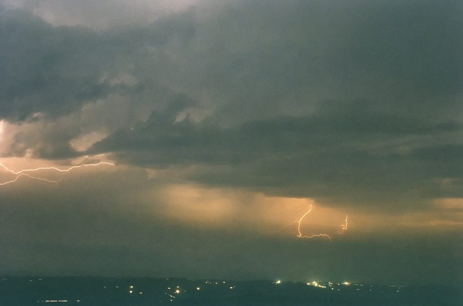
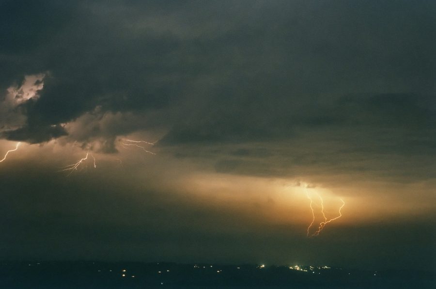
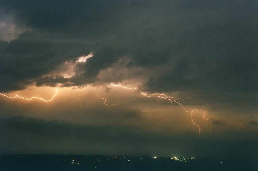
A few lightning photos taken by Michael Bath from McLeans Ridges:
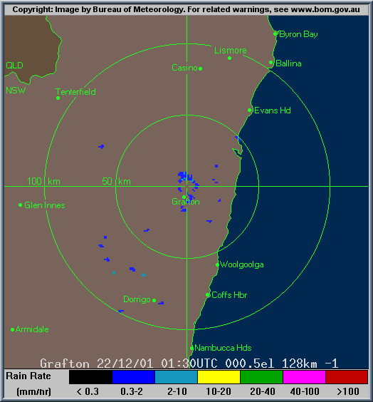
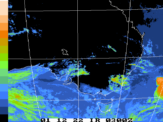
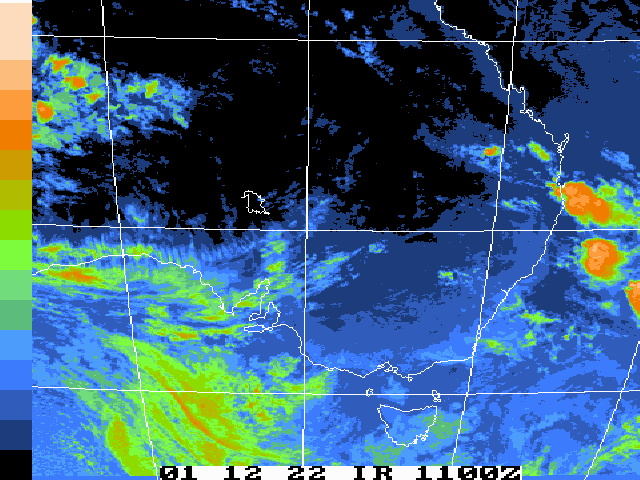
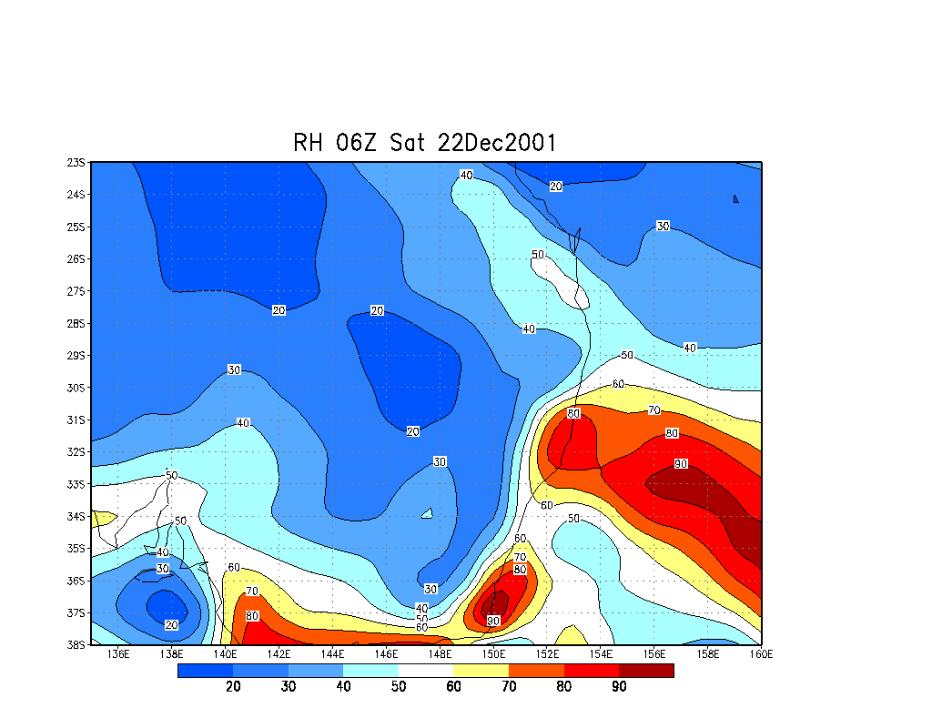
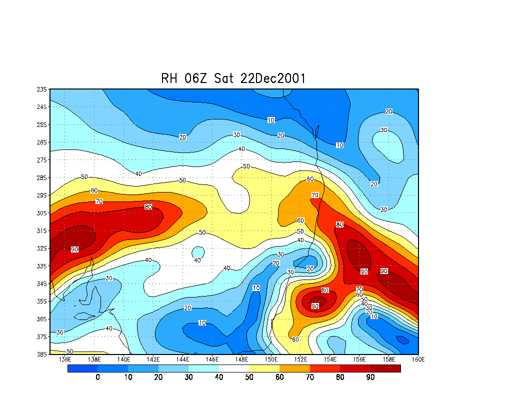
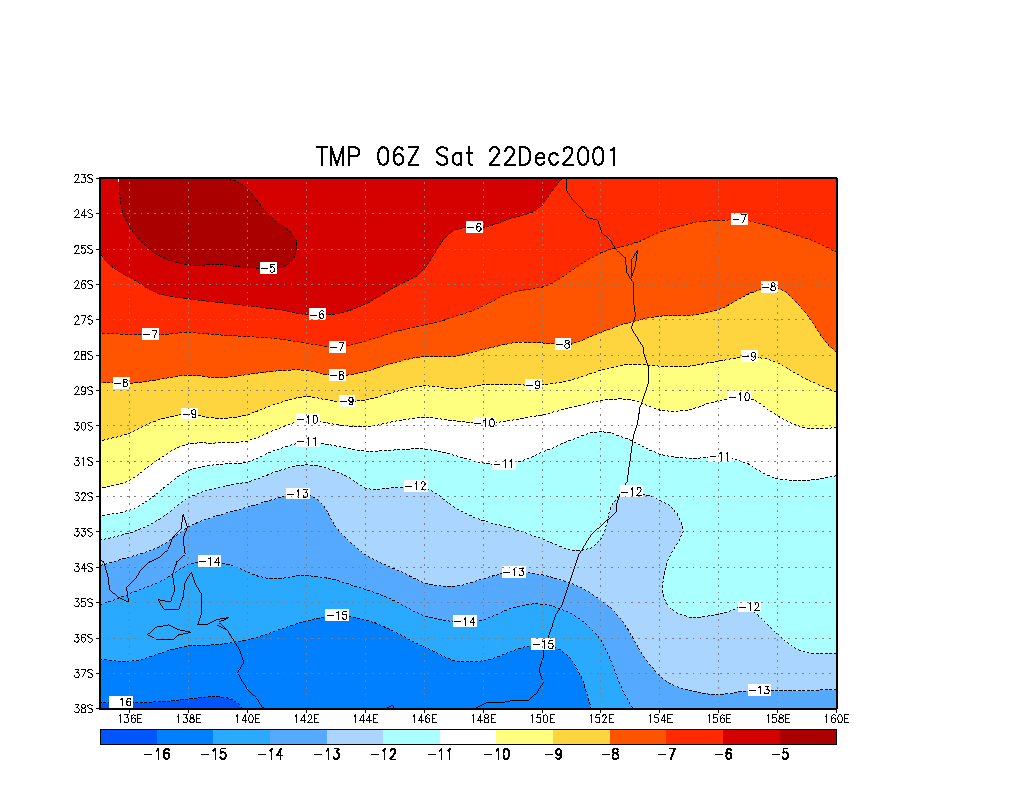
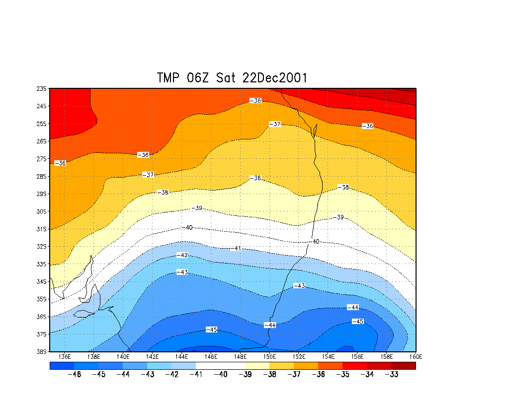
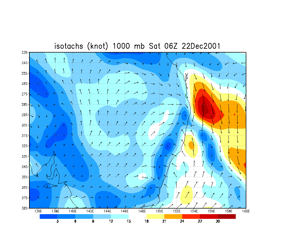
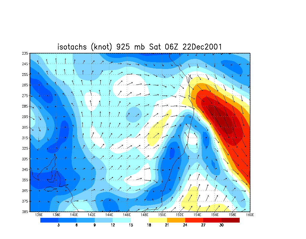
From Bureau of Meteorology.
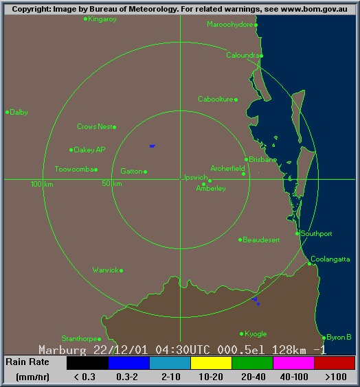
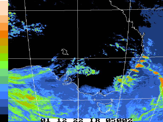
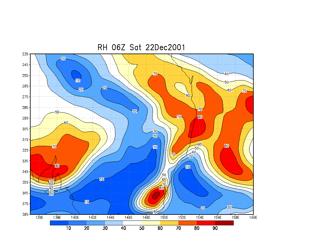
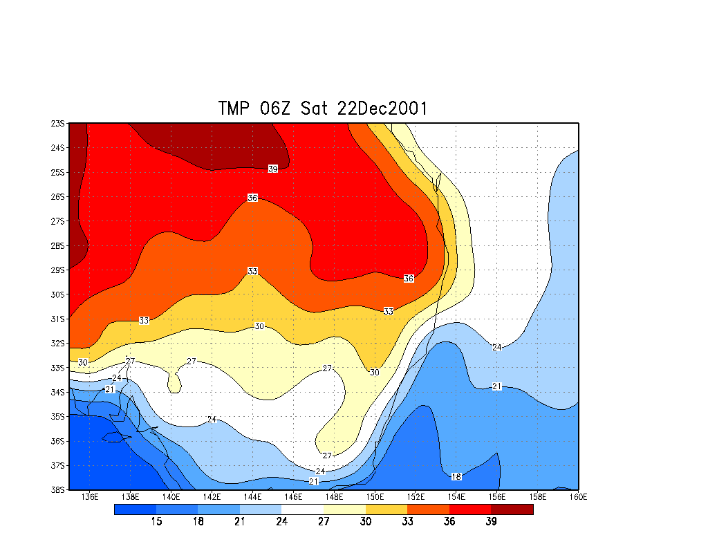
From Bureau of Meteorology.
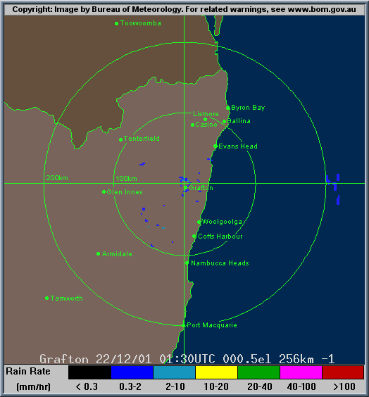
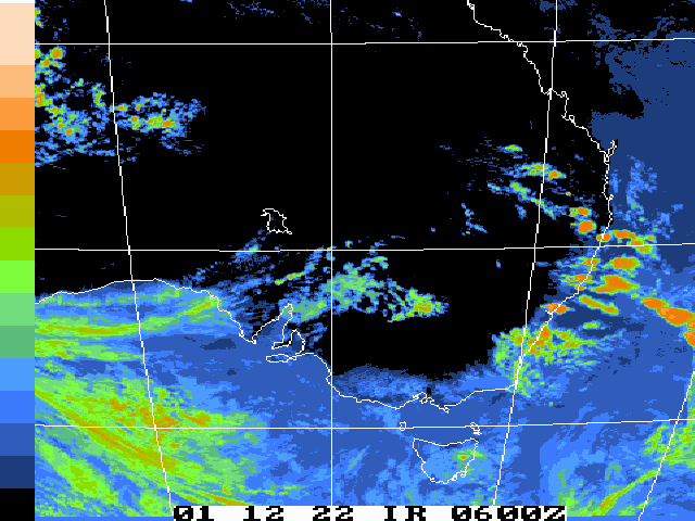
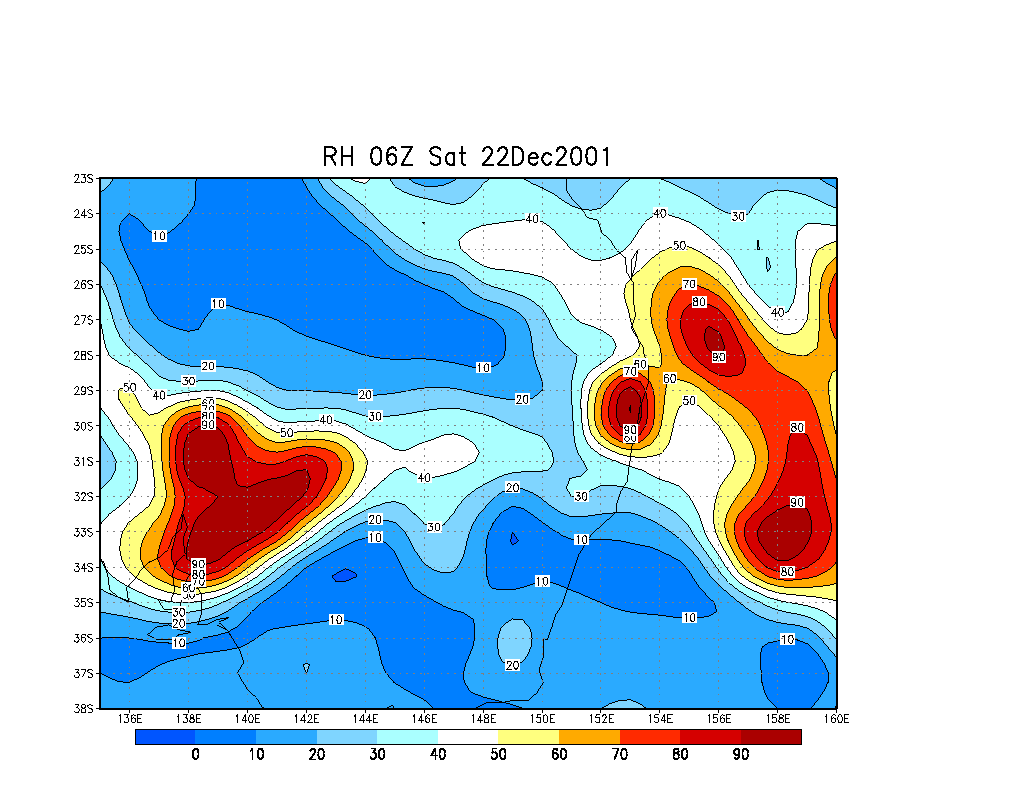
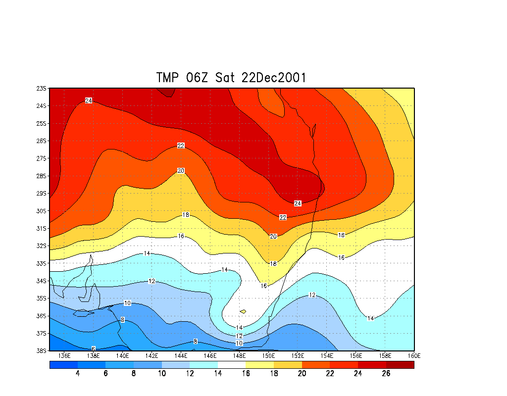
From Bureau of Meteorology.
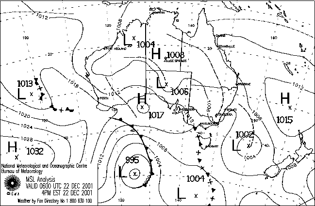
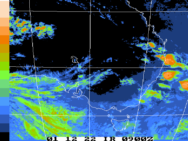
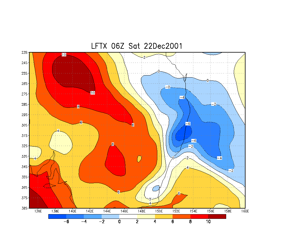
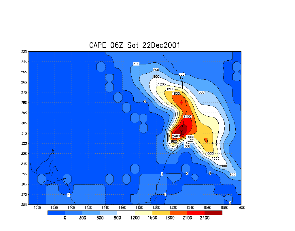
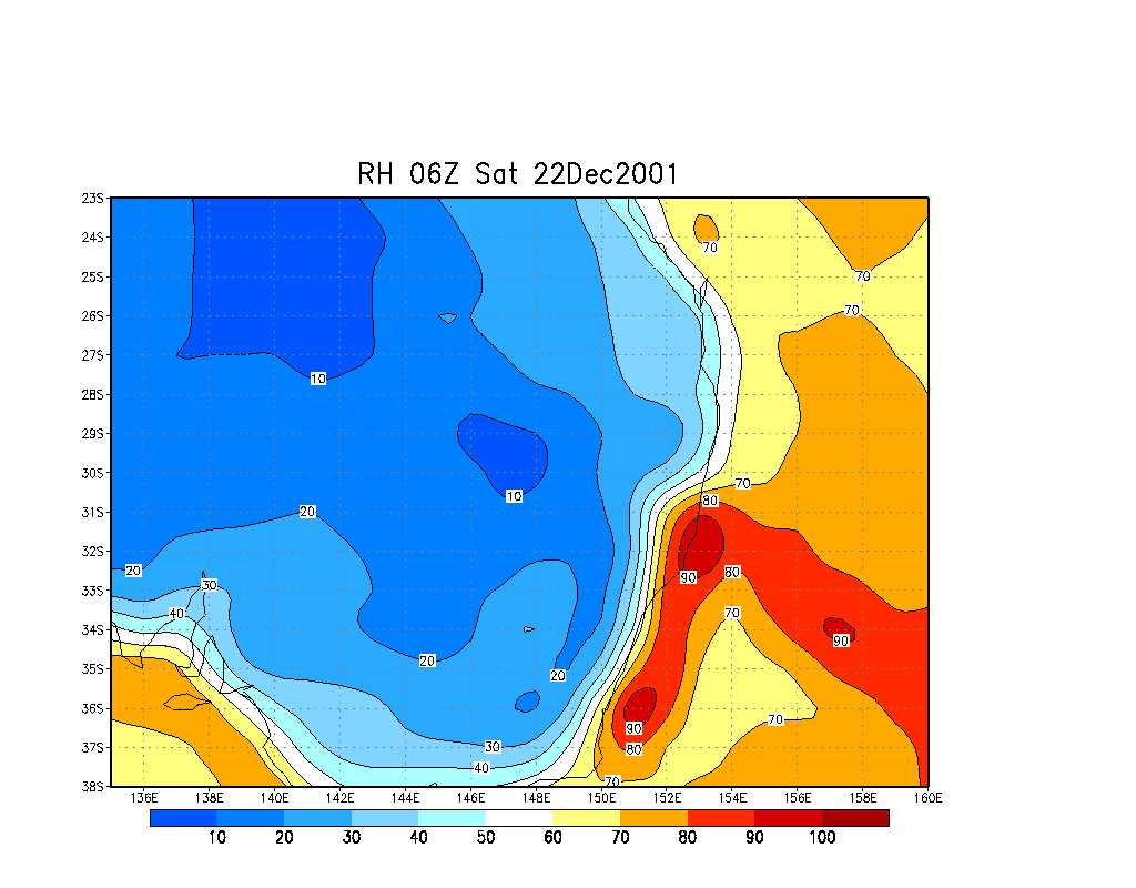
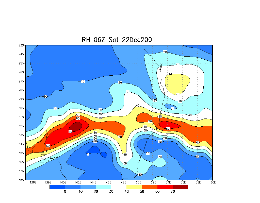
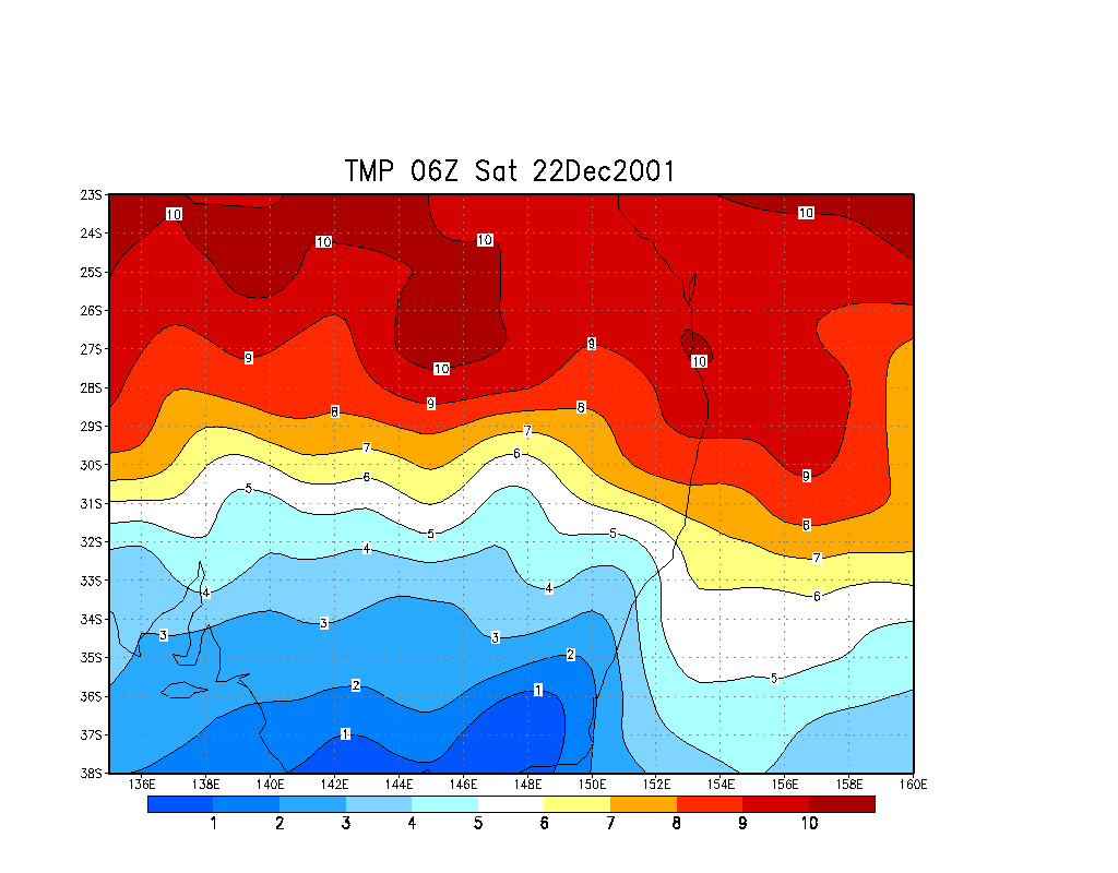
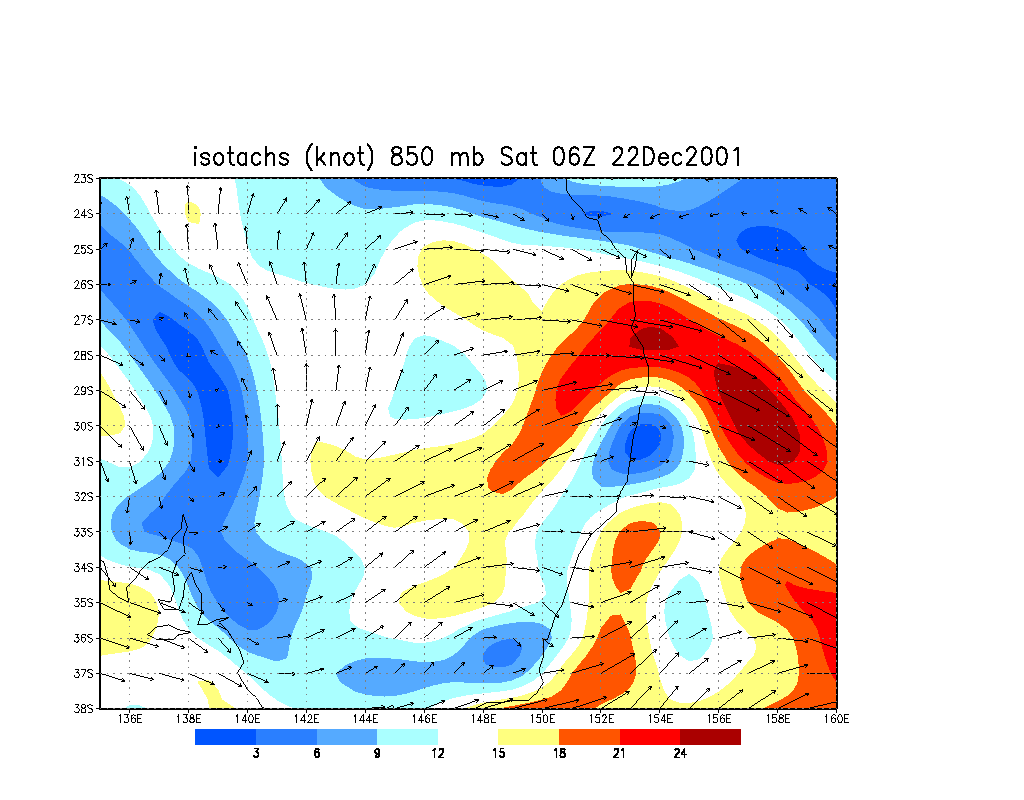
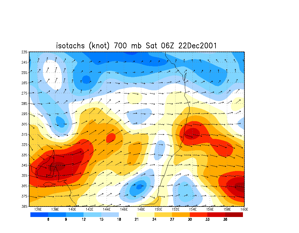
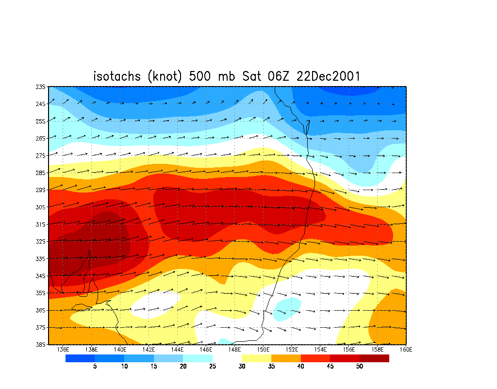
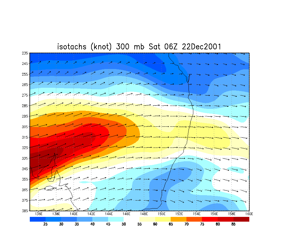
From NOAA 22/12/2001 06z run analysis
|
Document: 200112-02.html
Updated: 7th January, 2002 |
[Australian Severe Weather index] [Copyright Notice] [Email Contacts] [Search This Site] |