and Chasing
[Index][Archives]
Thunder Down Under Severe Storms Chase - November 24th 2001 to December 5th 2001
by Geoffrey Thurtell and Jimmy Deguara
| Storm News and Chasing [Index][Archives] |
Thunder Down Under Severe Storms Chase - November 24th 2001 to December 5th 2001 by Geoffrey Thurtell and Jimmy Deguara |
The Thunder Down Under Storm Chase 2001 is a continuation of a developed tradition from the the past two years. It was intended to be the equivalent of the vacation chasing in the United States May - June period. This year several chasers took part but mostly were split in three groups. I thought it was better to have such a group to cover more storms and have more variation. We basically did not meet up during the whole time chasing.
The main aim of chasing storms at this time of the year was to get the best period climatically when storms tend to fire. It tends to be more reliable than other times of the year but of course sometimes better outbreaks have occurred outside of this late November early December period.
What were we expecting? From what happened throughout the season, dynamic systems had regularly hit the New South Wales region with some severe weather outbreaks - something we have not seen for quite a few years. So supercells were obviously to be expected if we were able to choose the correct target area. The ultimate if we were lucky was to track down a tornado!!! From what had happened in previous years, I was going to try and keep the travel distances to a minimum.
Who's we?? The members that took part in the chase were;
I hope you enjoy the overall report on what I would describe as unique structured thunderstorms observed on this chase. There were two days when high precipitation (HP) style supercells developed. Low Precipitation thunderstorms (some probably supercells) were most regularly reported - very unusual for the northern part of New South Wales - well that is usually the assumption.
This report is a co-operative effort between Geoff Thurtell and myself.
This day was certainly going to mean a good start to the chase with an incredibly dynamic atmosphere particularly over the Sydney to the Hunter region. Winds at the surface backed from the northeast but not strong to my liking. However, the models were predicting varying from about 850hPa of about 20 to 30 knots to about 60knots at 500hPa and much stronger aloft. This mean that backshearing was not likely with supercells that did develop. The cap would prove to sufficiently strong to allow storms to break later. The moisture profile was ideal with drier cold air aloft.
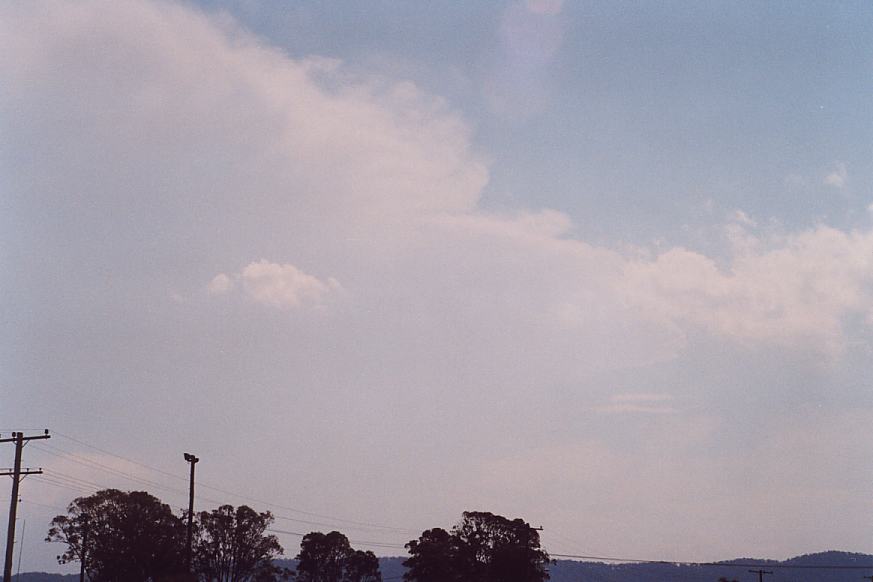
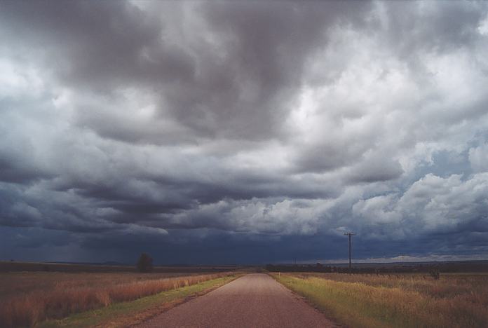
Our target area was around the Bulahdelah area but we were also considering the region towards Dubbo. Early morning thunderstorms greeted us but provided some heavy rain and occasional lightning bolts. So we headed up the freeway and met up with Nick and crew at Morpeth. The remnants of thunderstorm activity and also mid-level cloud developed throughout the morning. We could not see what was going on.
After lunch, I noted that there seemed to be more light to the north. So we made our way north, to Bulahdelah. As we neared Karuah, we could see extensive breaks developing. Nothing was occurring beyond these breaks. A game of cricket was in order.
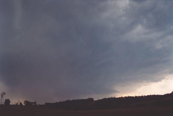
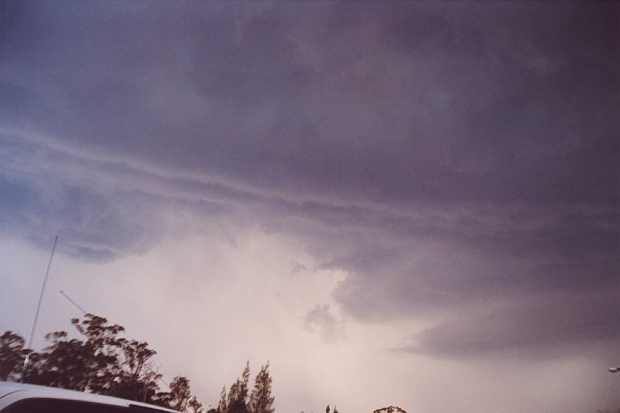
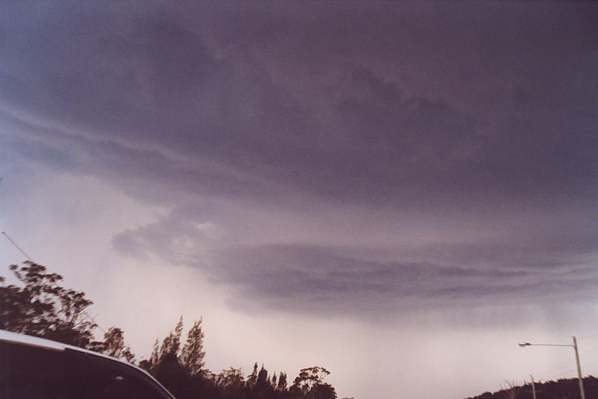
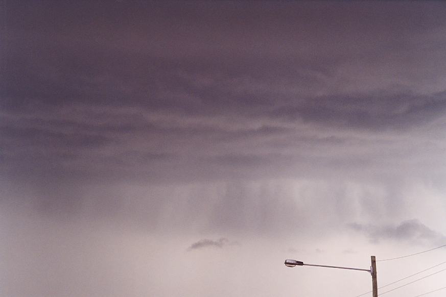
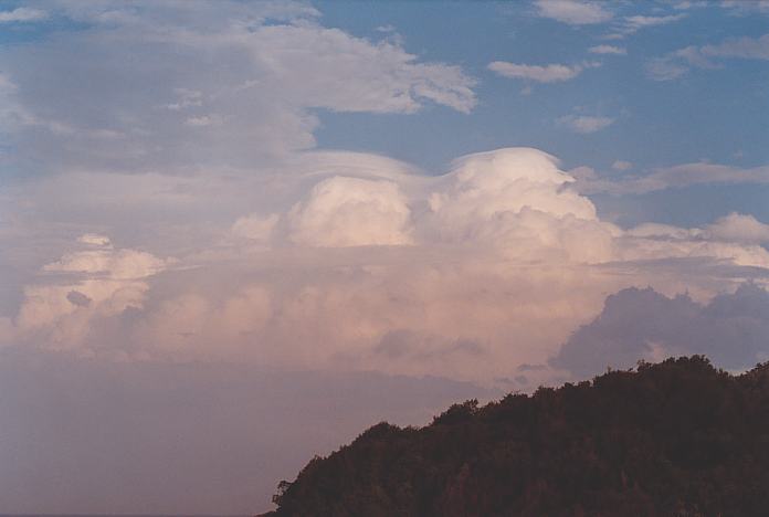
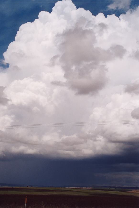
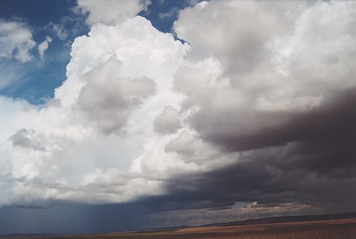
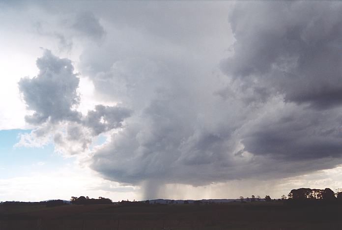
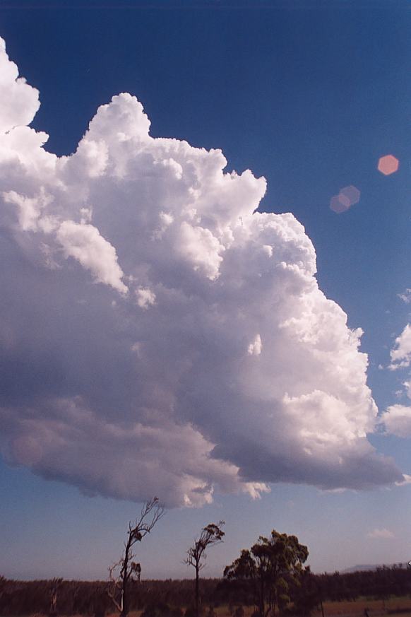
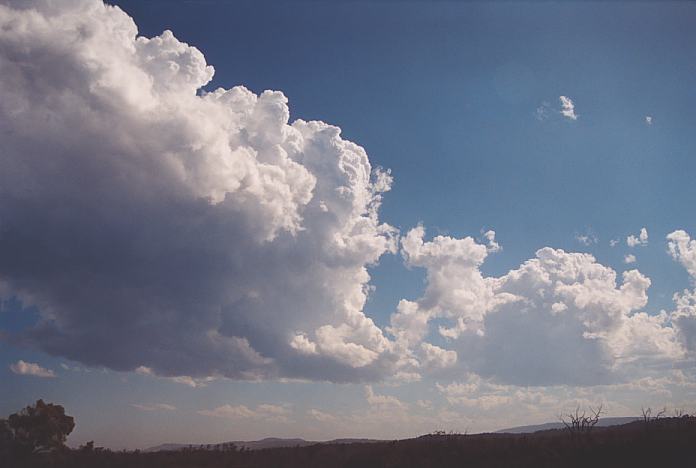
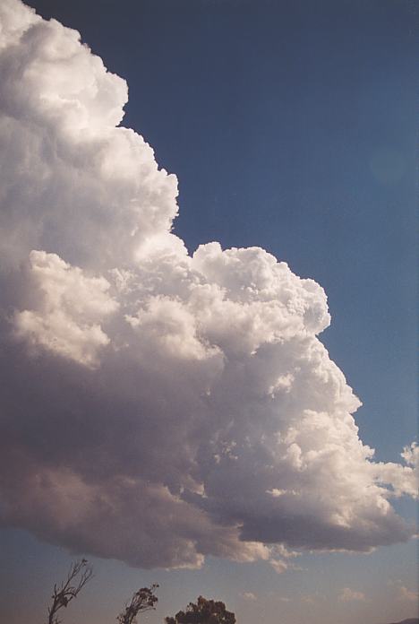
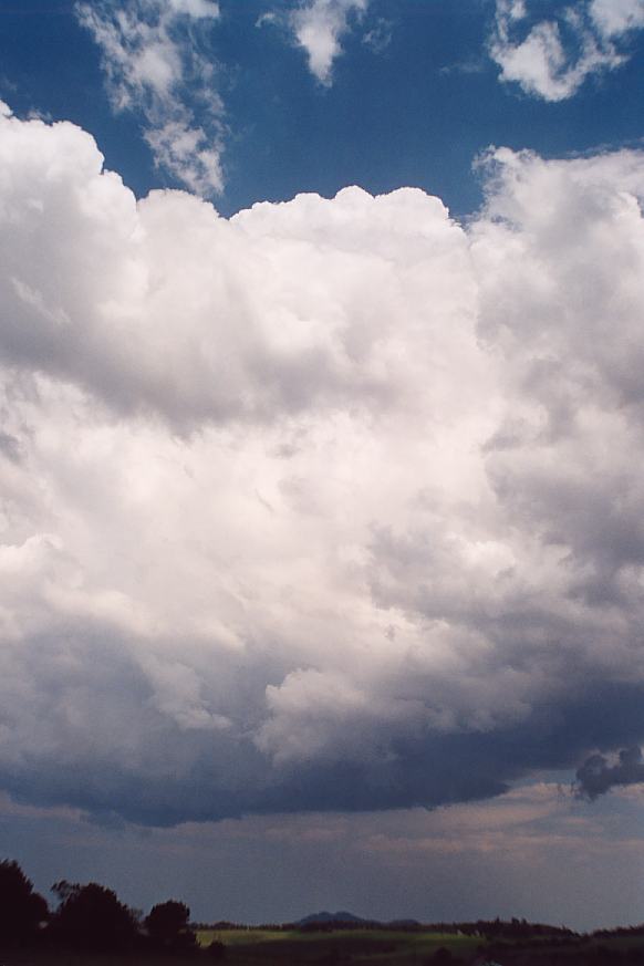
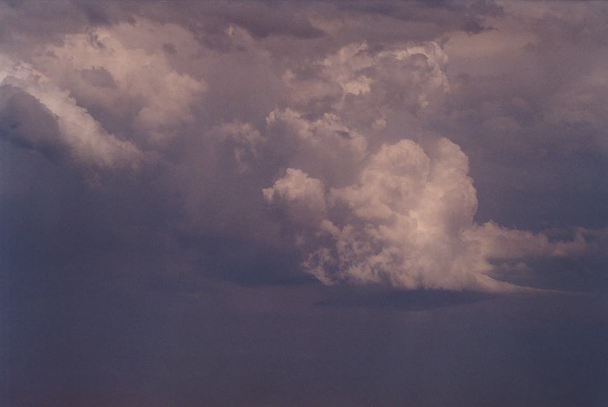
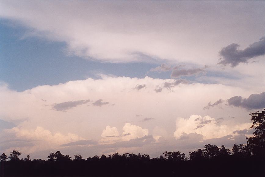
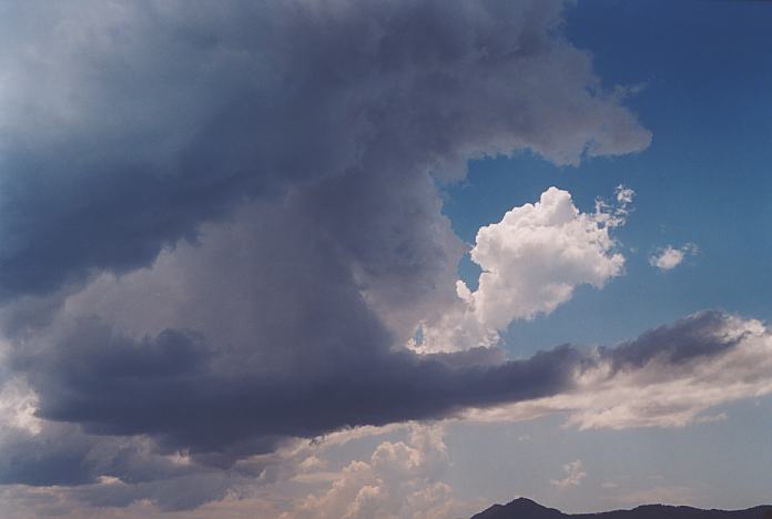
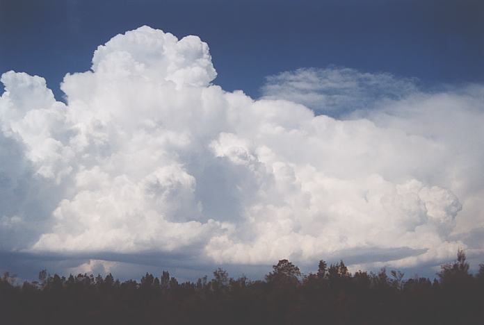
By about early afternoon, cumulus began to tower but kept hitting the cap. Cirrus was developing from the west as well. Static was now being picked up and then slowly, the cumulonimbus pulses increased and merged into the anvil moving fairly quickly downwind overhead and off the coast by 3pm. We decided to head a few kilometres south of town. Some particularly strong updraughts were observed to the southwest and some intense storm activity showed up on the radar over the Singleton region. As expected storms were moving rather rapidly. I was more interested in the tower developing just to the north of the main cell and judged the chase on a possible split of this cell. Though what the heck: lets get up close and personal. It was very dark base with green tinge. Severe lightning bolts hit the earth randomly. Nick and I got out of the car to get a better view. I thought what are the chances of close lightning. Within seconds -lightning flash up the road - followed by a loud bang that echoed in the valley. I was back in the car in a flash. Nick joked about it but I could see the startled look on his face. He got back in the car as well.
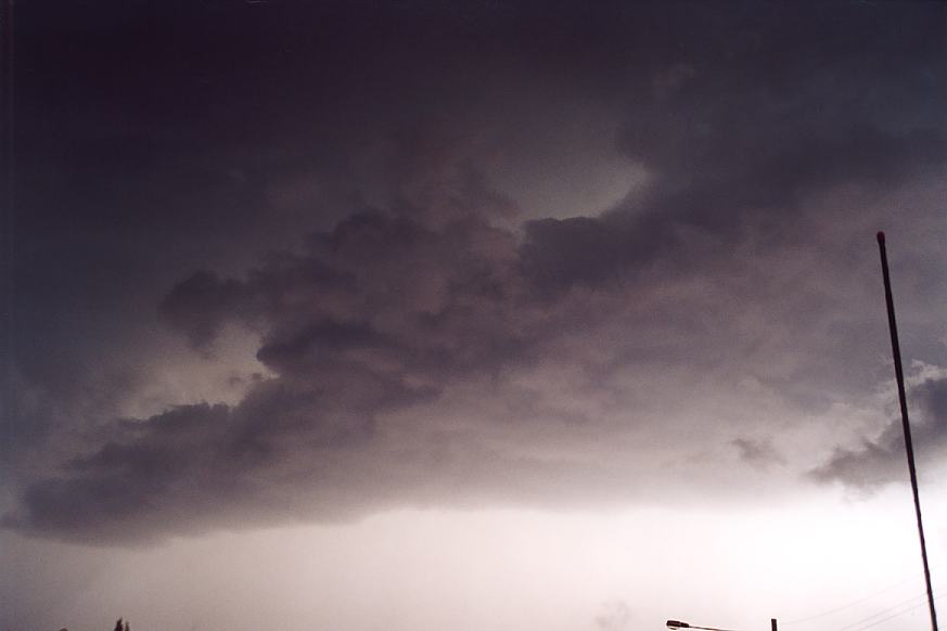
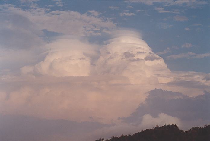
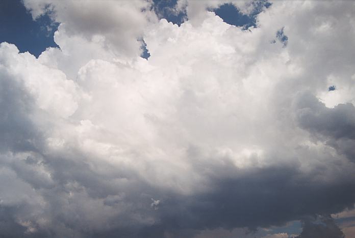
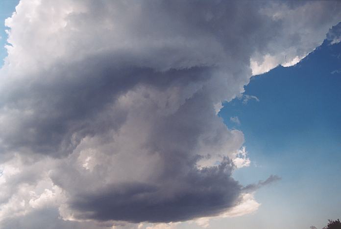
The base of the storm was slowly but surely showing some overall clockwise rotation. There were two suspicious areas that looked likely wall cloud formations: one to the northwest on the edge of the cloud base and another to the southwest. My thoughts were that the southwestern area was more likely to show rotation. It was an incredible dynamic storm system. Soon after, we were observing what looked like an inflow band streaming to the southwestern lowering and it had developed rather rapidly. You could note some slight rotation there though not significant. Meanwhile, the solid lightning bolts continued to blast the area followed by loud sharp echoing thunderous bangs.
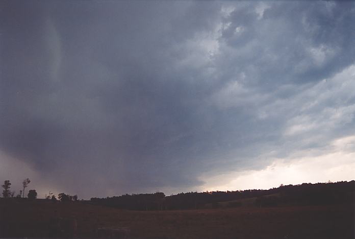
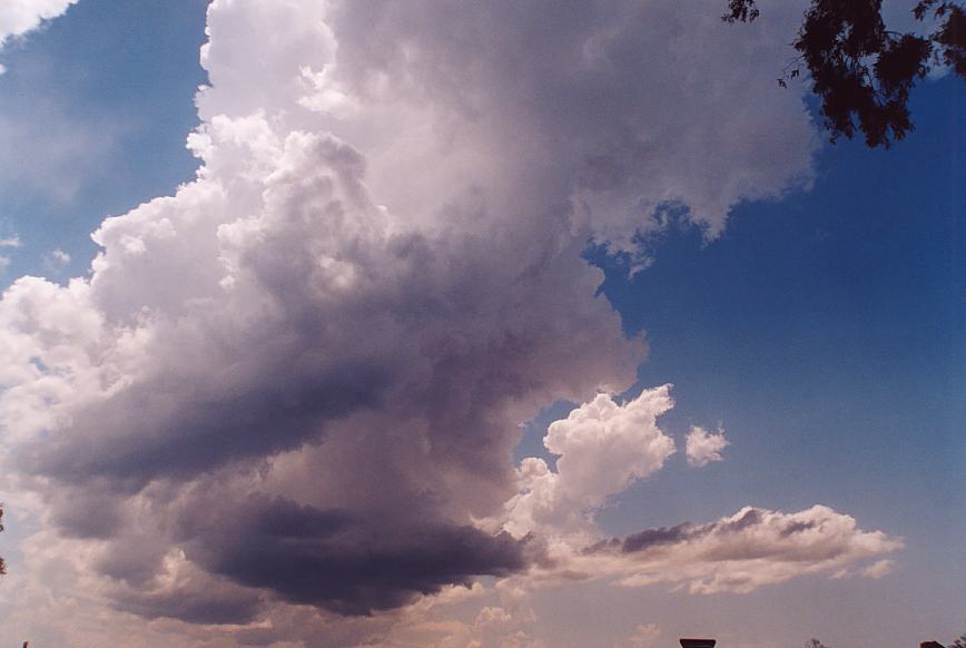
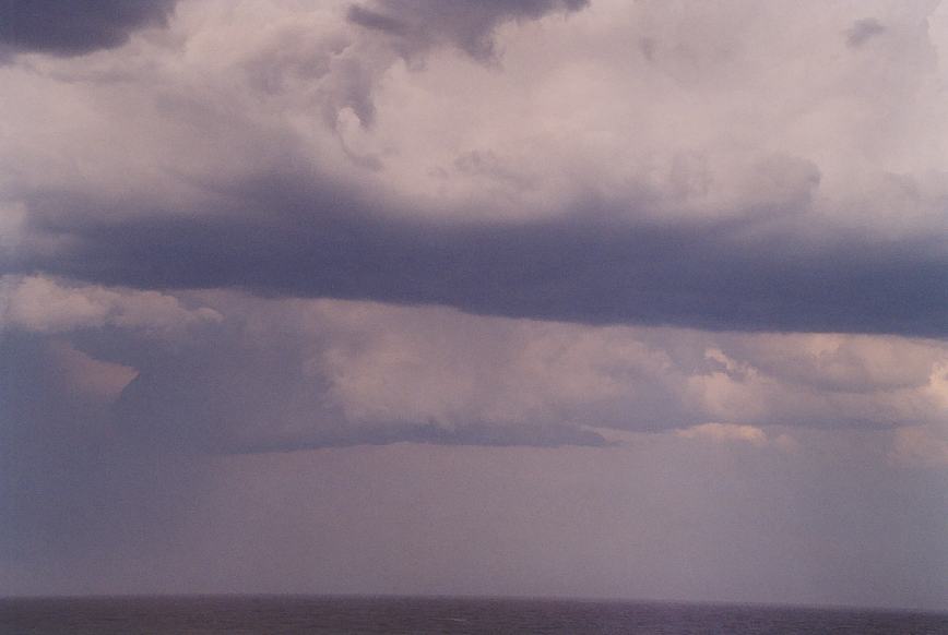
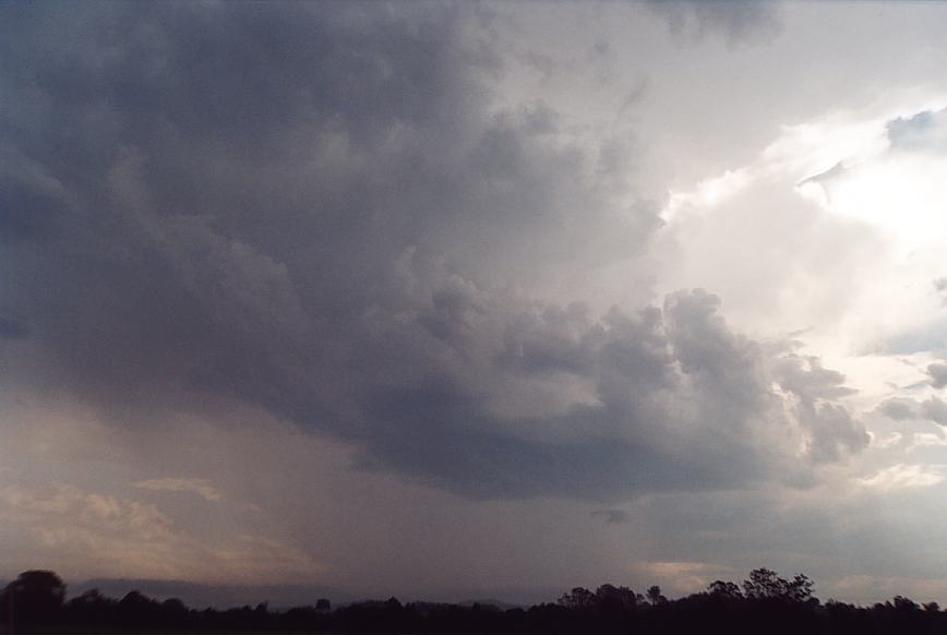
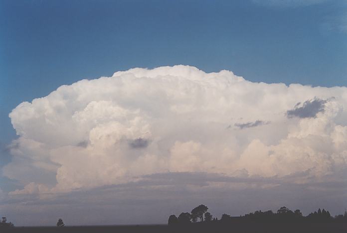
When the lightning activity ceased, we got a better overall view of the base structure. It was essential to work out which way the storm was going to head. Unfortunately, due to the risk of tornadoes on a limited choice of roads, we had to head north along the Pacific Highway instead of heading towards Seal Rocks and Forster. The storm began sending strong outflow winds northwestwards and you could see rainshafts rotating clockwise to our northeast. This is the first time I had observed precipitation rotating. In fact there was differential directional shear line from the within the precipitation core northwestwards. Shafts of heavy rain drops pelted the vehicles and the wind was certainly making the car rather unstable.
Slowly but surely we were distancing ourselves from the storm and to turn back and go to Forster, it was too late. The storm was moving rather rapidly though we could see glimpses of the base structure through gaps in the hills - certainly not the best chasing country.
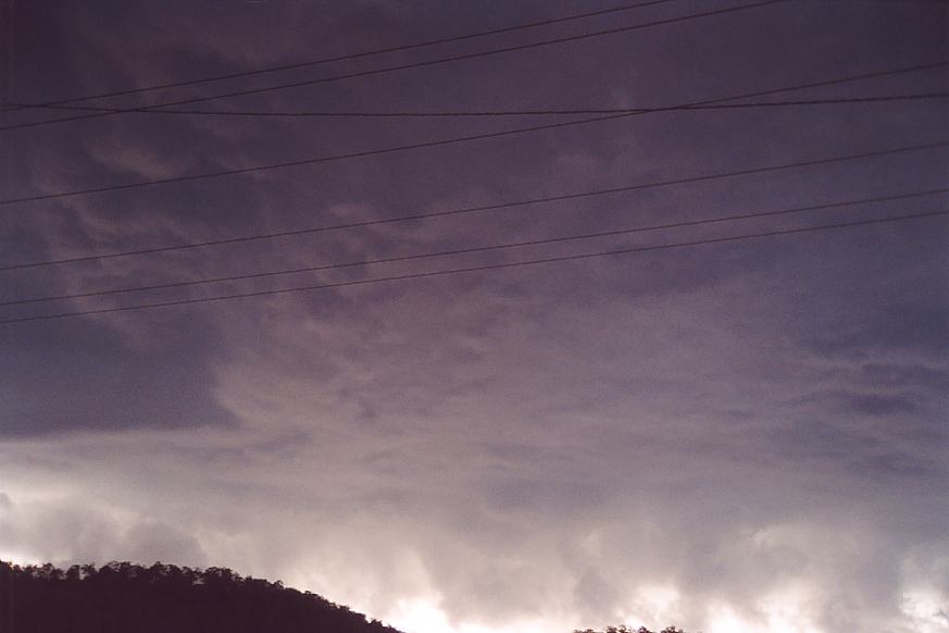
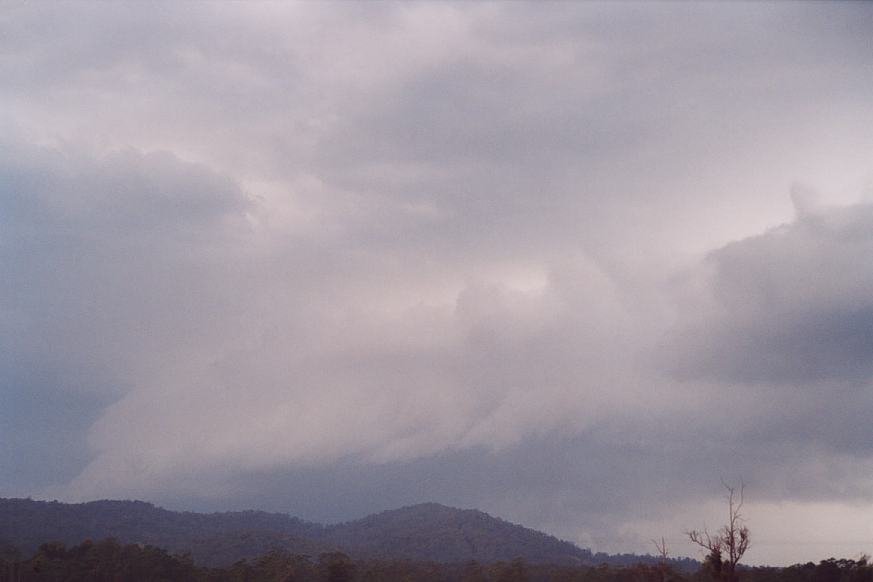
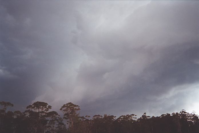
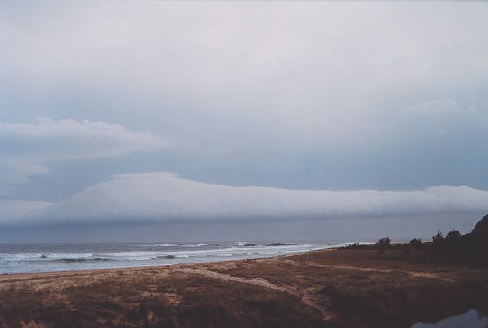
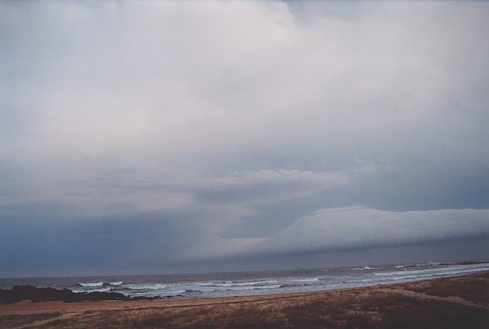
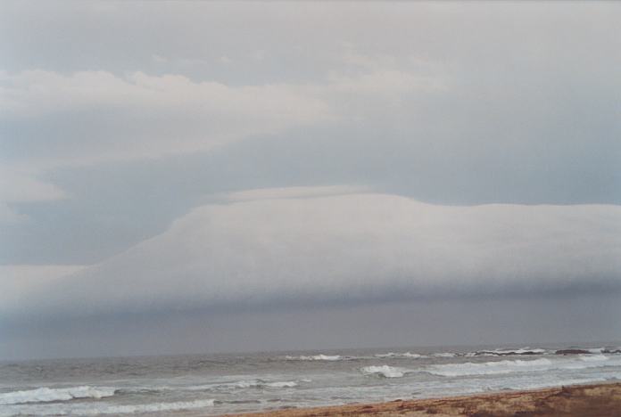
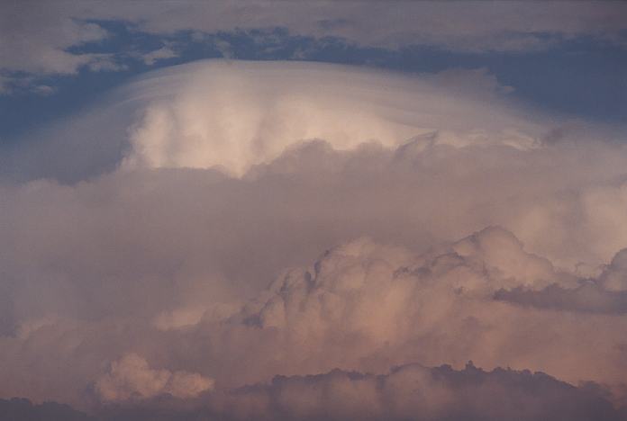
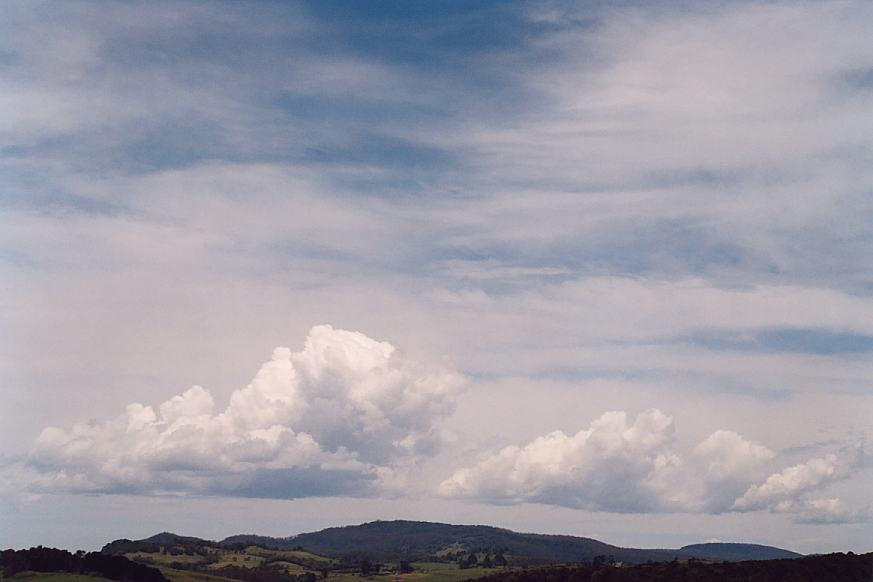
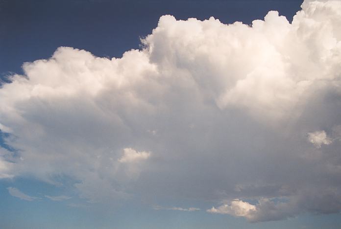
After making the trek to Hallidays Beach, we observed the storm not so impressive looking but with roll cloud curving around the back end of the storm. After this we headed up to the headland overlooking the beaches. We were impressed by the multiple tier pileus layering of the storm towers.
Incredible day!!! We had waited in the sun and humidity playing cricket and once the storm had approached, the action was over in an hour or so.
Today was mainly a day to re-position ourselves, do some food shopping and maintain and repair equipment.
An early morning check of lightning tracker and radar on Nick's laptop computer showed activity stretching from Moree to Narrabri and moving east-south east. We just steadily head north along the Pacific Highway during the morning. At 11:45 am, parked at the Bellingen - Dorrigo turn off, Nick's laptop proves it's usefulness again as we check the models and radar. The indications are that a rainband is setting in. The decision is made to continue on to Dorrigo, organise our accomodation, have some lunch and then relax for the rest of the day. We book into Dorrigo Mountain Resort and have an early night so that we can wake up at 5:30am on Monday to watch the Uraguay vs Australia World Cup Soccer Qualifying match.
Australia loses to Uraguay, 0-3. The low cloud and drizzle match our mood after the soccer match. We play cricket at Dangar Falls (2km from Dorrigo) and also play the waiting game. At about midday, a clearing to the west is observed. We have some lunch and then move to an elevated lookout west of Dorrigo where there is still digital mobile phone reception. At 12:15 pm, the BOM issued a Severe Thunderstorm Advice (STA) for the Mudgee area. Increasing static is picked up on AM radio and we observe plenty of cumulus development on the ranges but not much more. Nearing the end of the day we move on towards Grafton. We then head west along the Gwydir Highway towards Glen Innes. At 6pm near Jackadgery we finally observe the first lightning for the day. Between 6:20pm to 6:30pm we climb the Gibraltar range, experiencing heavy rain and lightning. At Glen Innes we booked into the Poplar Caravan Park and then headed off to the RSL for dinner. While we were eating, a fast moving storm with intense rain swept through the town. A blackout resulted in us finishing our dinner "romantically" by candlelight.
After the usual check of the models and satpics we left Glen Innes just after 8am for the Inverell area. We initially went to the lookout just west of Inverell but there was not much to see and no mobile reception. Jimmy knows of a spot at the intersection of Old Bingara Road and Warialda Road that has it all. There is mobile reception, a good view of the Mount Kapatur Range to observe propagation of cumulus cells and a good cricket pitch!
So from just before 11am until about 12:30 we whiled the time away with a leisurely cricket match. Nothing on the ranges seemed to be able to break the cap so by 1pm we were heading north of Warialda along the Boggabilla Road. Warialda and surrounds still showed plenty of evidence of the extremely strong straight line winds that were experienced during a storm a couple of days earlier. At around 1:15pm we stopped just east of Croppa Creek to have some lunch and some more observation. Due to the heat and the poorer quality of the pitch, we did not get too enthusiastic about the cricket.
By this time, another storm had developed to our south and was looking nicely set up. The storm was heading north east so we headed south and then east to intercept it. That was all of the action for the day. We headed off north along Warialda Road to Yetman, then east along the Bruxner Highway and then crossing into Queensland at Texas. Some low level creek crossings had water flowing across the road, showing that the rain had been quite intense although not prolonged. We then went north to Inglewood and east along the Cunningham Highway to Warwick. We observed storm activity to our north and east during this drive but did not observe much more than the odd flash of lightning. We stopped at Warwick overnight.
The conditions on this day were not ideal for outbreak conditions but there was sufficient shear, instability and reasonable moisture profile depending on the area you chose to target. Wind shear was more ideal further east but the moisture profile was better further west. So we targeted the area north of Delungra and Inverell.
We were in cloud as we waited east of Inverell. It wasn't long before we observed towers developing to the west near Bingara. So we made our way there stopping at a high point near town. Towers continued to develop over the North West Slopes region to our south and west. Another game of cricket (umm as usual Nick did not have pity on us and slammed his frustration with sixes).
A line could be observed developing further north and therefore it was time to move north into a more ideal wind shear environment.
We stopped in a region north of Warialda. The storms to the south were becoming impressive but the storms to the north were developing along a line east of our line. It was an awkward situation: the road network was not the most ideal in regards to the location and movement of the storms. Storms were developing to the north but the line passed through and winds turned northwesterly. Cold upper air sky was being observed to the west but dry air below. Eventually when a storm that had developed just to our east rapidly punched through the cap, we tried to head on a gravel road east. Admittedly, the contrast from the squall line system was nice (considering that squall lines are not my favoured storm). It was not particularly severe though but we had to settle for it. After being dumped on and receiving tiny hail, we headed north on the other road towards the Queensland border. From here, we headed east observing the major storms in northern New South Wales and some others to our north. We stayed the night at Warwick.
Another day of no activity in our part of the world. Jimmy wanted to catch up with Michael Bath so we headed off towards McCleans Ridges after checking our emails at Warwick library. We went sightseeing to Queen Mary Falls, near Killarney to have a lunch stop. Nick's car had an oil leak which was getting worse. As it is a company car, the leasing firm told Nick that he had to take the car to the Toyota dealer at Warwick. So Nick and Craig headed back to Warwick. Jimmy and I continued on to Michael's place.
The models were predicting another day of inactivity in this part of the world and Nick and his mate were still stuck in Warwick. As the next activity was due to fire up on the next day around mid - northern NSW, Jimmy and I decided to head towards Dorrigo to get into position.
We stopped at Ulong for lunch and had a yarn with a local man named Ray. He had memories of some severe storms in the area, many with large hail. His observation was that the most severe storms always seemed to approach Ulong from the north west. We then proceeded to Dorrigo, staying the night at the Dorrigo Commercial Hotel for a change.
9:00am saw us at Dorrigo library. AVN was down but the outlook for the day was promising so we meandered through the roadworks just west of Dorrigo to our now favourite lookout with the mobile reception.
10:45 - 11:00am saw the first convection of the day. 4:30pm A thundery shower to our NW dropped a Cg just to our north. Nothing further developed as this storm weakened.
5:20pm A pulse storm just west of Dorrigo dumped an intense shaft of hail and rain. The strong downdraft and outflow immediately cancelled out the updraft and the storm weakened and then collapsed. Michael Bath sent an SMS message to Jimmy to let us know that a large storm that we could see to the south was at Bulahdelah.
Nick was mobile again and chased a large storm in the Texas region of Queensland. It was too late for them to reach Dorrigo that night.
We stopped overnight at Dorrigo Mountain Resort.
We had split from Nick Moir due to car problems and he was forced to go back to Warwick on the 28th November to get the car fixed. He was well placed near Glen Innes but Goeff and I remained at Dorrigo. The conditions were not the most ideal due to mid-level moisture. The wind shear was good as was the case this season with all the upper level systems we had had.
But the main cloud band gradually cleared allowing for cumulus to develop. They seemed impressive at first but it seemed a cap had developed and flattened the clouds. This made the whole day frustrating and we knew then we were in for a long wait. During the afternoon, storms struggled but did develop with lots of small hail being reported around Ebor. Some close lightning bolts but very eratic. Some other storms were observed to the far west that Anthony Cornelius and crew had chased near Mullaley and also Nick and Craig chasing storms in the border regions near Texas Queensland. During the night, we could observe lightning from a storm way down south - yes you guessed it - a probable supercell in the Bulahdelah region.
The owner of the resort showed us a video of an impressive morning hail storm that Dorrigo experienced a few years earlier.
Nick finally caught back up with us and we headed towards some convective action along the coast. Around 4pm at Corindi Beach, we witnessed the impressive rapid development of an updraft along the convergence zone between the NE seabreeze and a SE change. We had been experiencing W - NW winds at Dorrigo and these winds were combining at the convergence zone to create a triple point situation. At Ballina, another storm out to sea in the early evening displayed a very nice lightning show.
We stayed overnight at the Cedar Lodge Caravan Park, Ballina.
This was potentially an excellent situation with a triple point to be located right near us during the afternoon. The moisture profile was excellent and heating was not a problem. Wind shear was also excellent except for one thing: winds were turning too quickly northwesterly by 850hPa. This would introduce a strong cap but this should be broken by the change.
We remained in the shade at a lookout in Dorrigo for most of the morning. We did not like the northwest winds that replaced the northeasterly winds during the late morning period. Clouds that had developed had decreased and the air looked dry. You could clearly see the convergence to the east and healthier cumulus towers. Time to move.
We headed down the escarpment towards the coast and had lunch at Bellingen. The air was extremely humid and a fresh northeasterly was blowing here. Weak towers were developing but nothing substantial. So we progressed to a vantage point north of Urungah. The change could be observed to the south moving up the coast. The cumulus to our north began to strengthen so we moved again through Coffs Harbour towards Corindi Beach. Nick was to our north. It was extremely hot and humid but we enjoyed the very crisp towers rising almost overhead.
Heading north was nothing but a mistake!!! Firstly the cell to the north collapsed not long afterwards. Second - the cell to our south which we were so close to had taken off perhaps offshore very close to the region and had drifted left up the coast producing a lightning show. We observed some of the lightning from Ballina.
In the morning we drove up to Michael Bath's place and checked the models and satpics and watched some video footage of what we had seen so far. Anthony Cornelius and Andrew Macdonald also arrived and we compared notes for an hour or so.
There was not much promise for the day. We headed off to Tenterfield and had a nice roadside barbeque, the only problem being that the flies thought that they were invited, too. We watched some storm development further north in Queensland and decided to get closer. By the time we had got to just north of Stanthorpe, the storms had weakened considerably. We paid a courtesy visit to the lookout above Stanthorpe (as there was no more storm activity to observe). We then headed back to Tenterfield and stayed the night at a local caravan park.
A check of the models and satpics led us to the conclusion that the activity of the day would be around the Dorrigo region again. Jimmy correctly pointed out that there would be storm activity in Sydney, it was just too far for us to travel in one stage to get there.
So in the still coolness of the morning we headed off along the New England Highway towards Glen Innes. We took a detour to the Sinclair Lookout on Inverell Road. All of the development was occurring in the Dorrigo region, so we headed back through Glen Innes and on to Ebor. While we were eating lunch, we kept our eyes on a large storm to our south east. We travelled on to Dorrigo where a brief observation stop revealed that the storm was on the escarpment and heading towards the coast. It was hot and there was no further development so we headed south along the Pacific Highway towards Macksville where another weak storm was observed. It soon collapsed, however, Jimmy received the first of a few phone calls informing him of the severe storm outbreak that hit the Sydney region. Strong outflow winds were the main feature of these high based storms, with a record wind gust being measured at Richmond.
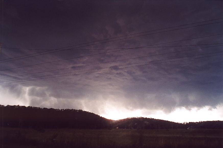
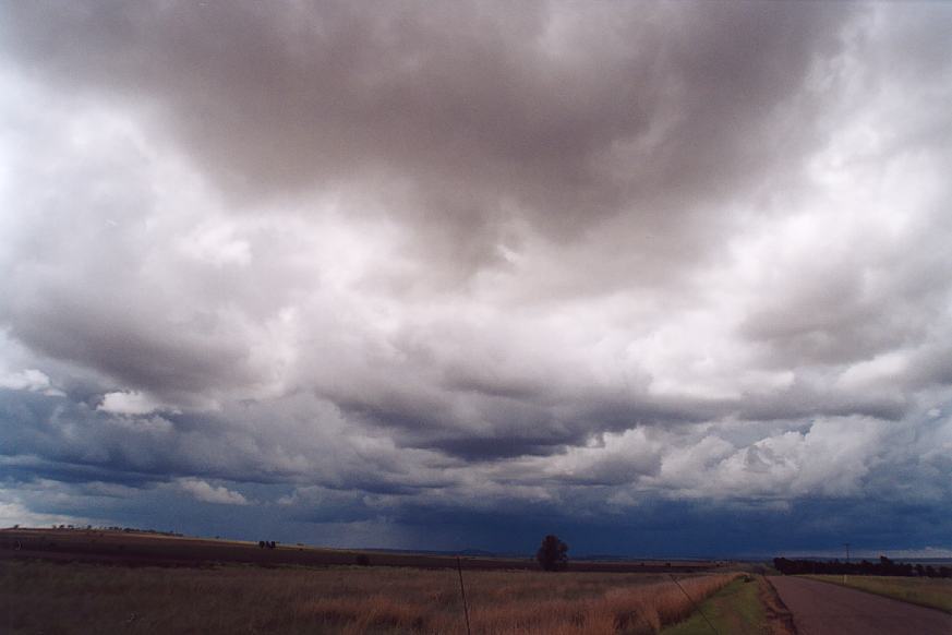
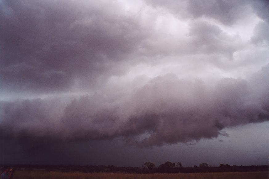
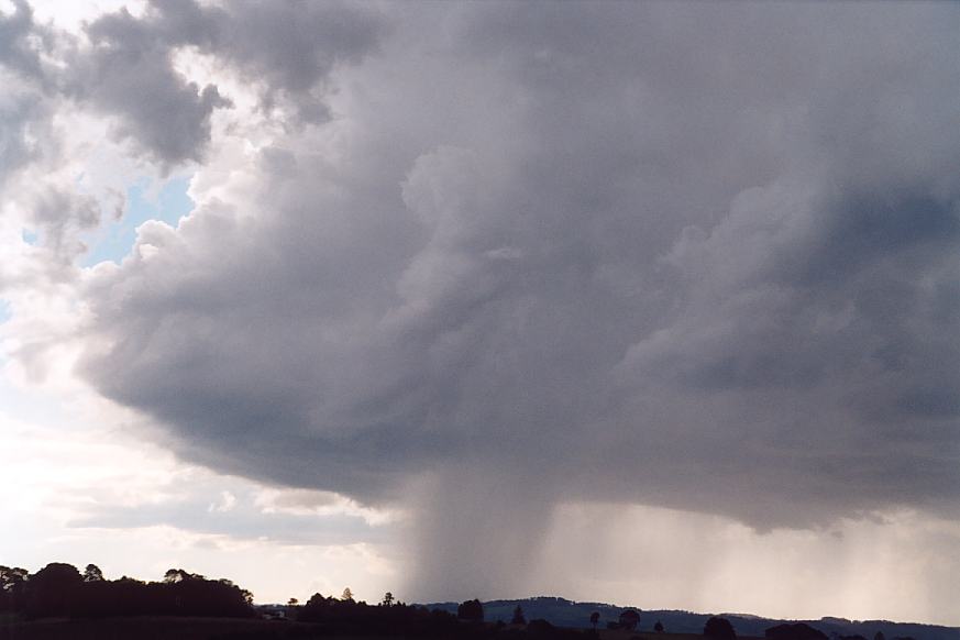
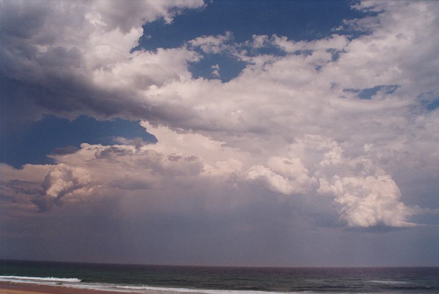
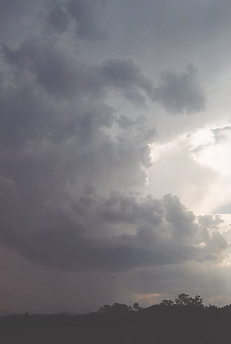
We could get into position near Kempsey to intercept this storm system as it moved up the coast. The timing was perfect as the line of storms appeared over the horizon just as the sun set. The line had developed many of the characteristics of an MCS complex. As we set up our tripods and cameras, it was difficult to decide which cell to concentrate on. For me, as it turned out, it did not matter, as in the dark I had accidentally bumped the shutter speed selector on my camera off the 'bulb' setting. As I am partly deaf and also due to the excitement of observing this storm complex, I did not notice the double click of the camera as I took each shot. The end result: one and a half rolls of blank film! The lightning displays were impressive as different cells appeared to take turns in being the most active. There were CCs, anvil crawlers and CGs with seemingly infinite combinations of all three. It is difficult to put into words what we were seeing. Jimmy's and Nick's video records of the night are the best way to experience what we observed. As the storms got closer, we moved north - north east along the South West Rocks Road taking every opportunity to stop and film the amazing sight. Eventually, of course, we could go no further as we reached the coast. It was now well after midnight, so we tried to search for accommodation as the storms passed overhead. South West Rocks is a typical sleepy coastal town and there was not a motel or caravan park that was open to receive visitors. We slowly travelled over the road back to the highway, which was awash in places after the heavy rainfall, and eventually reached the 24 hour motel at Kempsey. We were exhausted but elated. Initially it was difficult to get to sleep but in the early hours of the morning we managed to get a few hours of well earned sleep.
This was yet another day where wind shear was ideal but the cap was very strong. There were potential targets further to the west along the trough where even supercells were possible but also along the coastal strip if the cap could be broken, it was also a potential target. We positioned ourselves at a lookout firstly near Glen Innes. But the dreaded northwest winds developed so we headed east of town. Towers were developing nearer Ebor but also to the far south and southwest.
It was inevitable: the cumulus to the east were too tempting. Heading southeast, we made it to Ebor where we had lunch. Wow!! A storm had developed nearer Dorrigo. We were off in a flash. As we neared Dorrigo, it became clearer that the storm was just east or southeast of Dorrigo. Next move? There was occasional static oberved on the radio. We checked the internet and observed that the trough had developed rapidly to the west. So we headed south towards Kempsey. Anvils were extending through though the main storms were well to the west and southwest. An advice had been issued for the whole region. Around Kempsey, it was quite interesting. We had to wait as storms began to show up after sunset. The northeaster was blowing quite fresh.
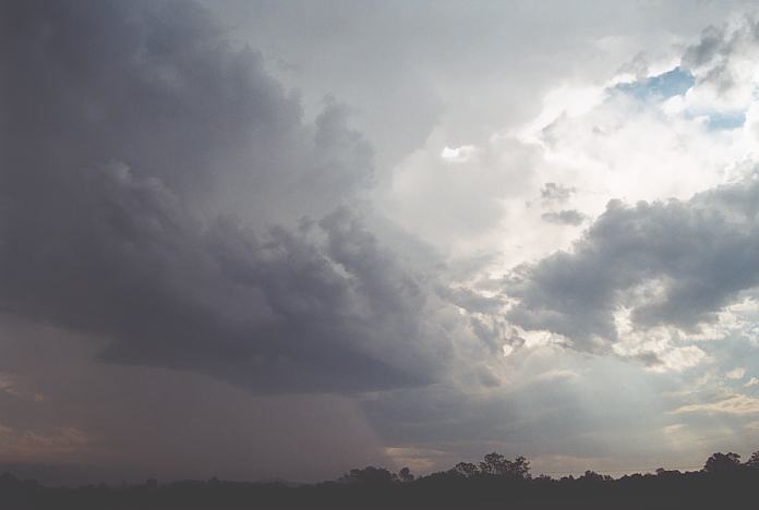
Lightning obviously increased in frequency as the cells neared. There were some strong bolts mainly to the south. Another intense cell passed in the region probable near Bulahdelah. Nick snuck onto the other side of the road and got this impressive shot with myself silhouetted within the lightning. The rest of the night was great with the storms combining into a Meso Convective Complex. You know when this happens, you are in for a lightning show. After making to South West Rocks we headed throught the rain and back to Kempsey for accommodation. We had heard about the severe storms and damage caused by storms in Sydney (severe microbursts) and similarly at Tamworth.
More severe storms are forecast for the mid to far north east of NSW and inland as far as Tamworth and Gunnedah. The AVN supports this but the area of best convergence, LI, CAPE and humidity looks to be in the Coffs Harbour region. We move to the lookout / picnic area north of Urunga at the Repton turn-off. The waiting game begins.
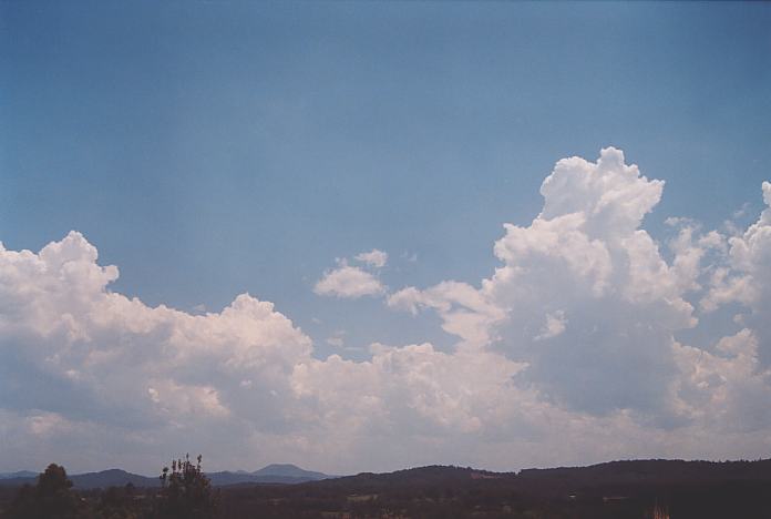
At around 1:45pm the first organised storm for the day takes off just to the west of us. Right from the beginning it demonstrates good turning from the lower levels through the mid-levels and into the upper levels. The turning is from NE lower level winds to WSW in the upper levels. The LI in our region is reported to be -8 to -9. The storm becomes isolated with nothing to the north of it. There are strong updrafts on the back end of the storm. After about half an hour the storm is taking on LP characteristics as it develops on the dryline. There is a strong corkscrew updraft on the back end. We give chase as the storm heads towards the coast. After Jimmy and I took a scenic detour trying to find a way through on local roads, we finally met up with Nick and his chase partner again at North Beach, Mylestrom. Here we watched the LP supercell develop into a classic supercell complex out to sea. As we watched the further development of the earlier storm and a smaller storm that developed inland behind us, we realised that a SE change was moving up the coast south of us and that there was a supercell that had developed on the moist SE inflow. The North Beach life saver who was on duty said that it looked like it was heading towards Scotts Head. We headed south west along the highway to see what we could see.
We stopped at Warrell Creek on the Scotts Head Road to take some photos and then moved on to Scotts Head where we were able to photograph the inflow band and some nice lowerings as the storm moved out to sea.
We stopped at Nambucca River Caravan Park near Macksville. The area is quite idyllic but Jimmy has voted it the mosquito capital of Australia. At night it is very wise to stay behind the protection of the insect screens.
Even from the night before, this was shaping up to be an incredible event!!! Surface Lifted Index had been moderated by the models to -8 or so though the moisture profile was more ideal around Coffs Harbour. Wind shear would improve during the afternoon. A front was heading up the coast with mid-level moisture alon this wind change. So we took our time doing some shopping and gradually made our way to Coffs Harbour.
We parked near the usual vantage point north of Urunga. The afternoon became a procession of small based tall cells which I immediately suspected to be LP cells (perhaps the odd LP supercell). Nothing was developing to the immediate north yet as we neared North Beach, numerous cells were developing and glaciating to the south.
An advice was issued for the region from around Kempsey to Evans Head. Wierd - it seems there may have been a stronger cap further north or a shallower moisture layer. The cells developed and moved off the coast with the occasional cell moving right almost heading backwards. After some time filming these cells merging off the coast into a complex, I took interest in the anvils to the southwest. A southeast change was moving up the coast with stratocumulus moving inland.
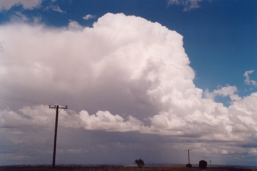
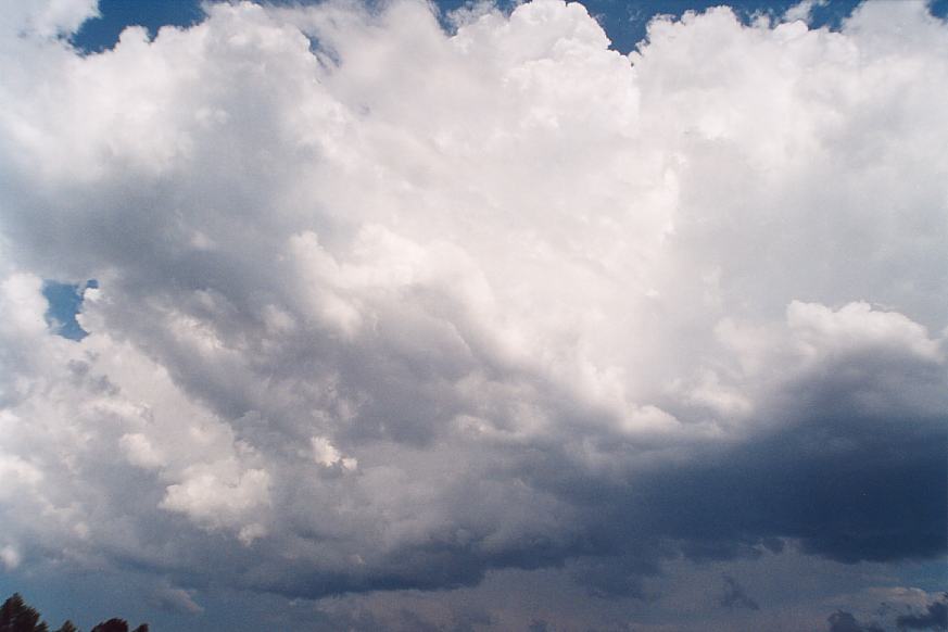
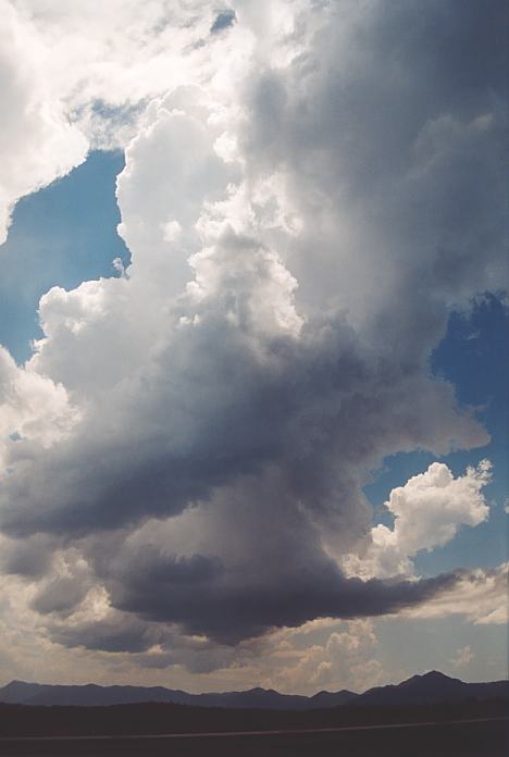
So we made the move - and it was like a timing device. It was like we had triggered something! The cells off the coast had begun to consolidate and were becoming larger. They were rapdily organising. Even within 10 minutes just short of the main highway - the cells were aligning into a flanking line step structure. But as we headed south, it was finally obvious the complex were organising into a massive supercell - truly awesome!!! As we headed south, this was filmed and photographed at any availablke opportunity. It was one of the few times you were happy to be in traffic...
We eventually parked ourselves nearer Warrell Creek. A storm had developed to the west on the northern side of the cluttered complex of storms. This gradually approached producing a couple of major updraught pulses observed from the crisp side anvil (Anthony Cornelius also confirmed this). I could see slight overall storm rotation. The rear flank downdraught precipitation was separated from the rainfree base. But the winds being southeast were not ideal to maintain this activity. The storm gradually began to weaken on approach even though hail probably occurred to our south. The storms from this point on were not that impressive even once we headed towards the coast.
The models did not show much chance for activity today, except for SE Queensland. As Nick had to head back to Sydney and there is nothing promising for the rest of the week, the vote was to return to Sydney.
The longish drive allowed us to review the chase and also to observe some of the damage to trees, which first became evident in the Bulahdelah area, from either the 24th November, 30th November or 3rd December storms. It was difficult to be sure which storm caused the damage and this demonstrated the unusual nature of the Bulahdelah region, which seems to attract more than it's fair share of severe storms. There was also some more severe damage on the northern outskirts of Sydney, most likely just from the 3rd December storm.
After reaching home, we organised for our films to be developed and then settled for a welcome rest before returning to work on the following Monday.
 I then became suspicious of a larger cumulus cloud to the southwest. I then remembered that the cirrostratus was elongated and showed signs of anvil. It was a storm which was hardly visible and the anvil was already off the coast!!
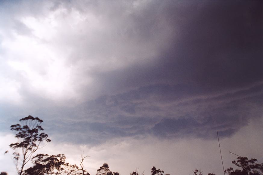
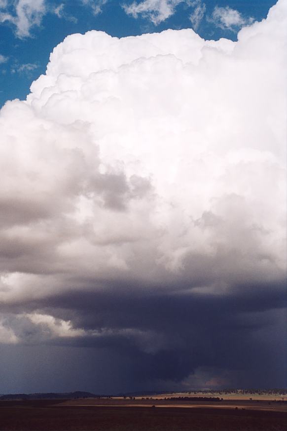
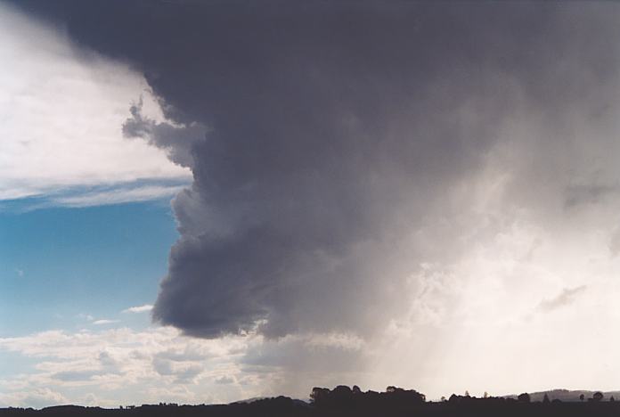
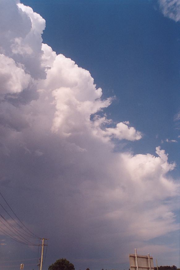
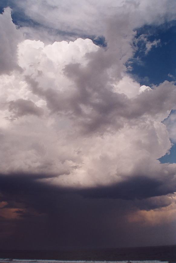
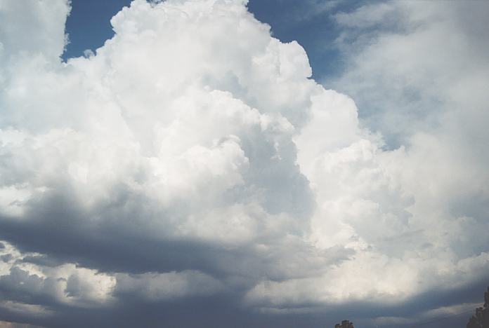
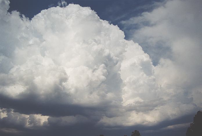
 As we headed further south, the storm still showed supercellular structure with twisting updraught tower. And the new updraught was rapidly organising. It was sending pulsing lightning strikes from the rain free base. It became merged into the main storm as it weakened. And it was this storm cell I knew was going to make the sharp left move. And it did!!! We viewed the storm a little longer from a location north of Karuah and then headed back towards Bulahdelah.
 The storm was making its move and was very severe. In the rear vision mirror, I could see the dense precipitation and hail shafts filling the view. To our left (west), was a huge rain free base. It was in this region that we would have to watch for any rotation and probable lowerings. Winds were gusting towards this region but as we made it to our original spot just south of town, we stopped.
Sunday, 25th November 2001
Write-up Geoffrey Thurtell
Monday, 26th November 2001
Write-up Geoffrey Thurtell
Tuesday, 27th November 2001
Write-up Geoffrey Thurtell
 At around 2pm the convective action became more pronounced and cells began to break the cap and show some organisation. We drove further north to just south of North Star and watched a beautiful storm well to our north in Queensland. There was some excellent back shearing of the anvil and what looked like an active flanking line. It was just too far away for us to catch. A nice cell developed and organised just to our east. We tried the unsealed connecting road between Boggabilla and Warialda Roads but soon decided that Toyota Camrys are not designed for wet black soil roads. So back to the bitumen we went.
 It developed strong gust front characteristics, so we parked off the road with the cars facing into the expected direction of the wind. The storm was soon upon us. There was definitely strong outflow winds ahead of the storm, buffeting the cars and breaking small branches off trees. We then experienced heavy wind driven rain for about ten minutes.
Tuesday 27th November 2001
Jimmy Deguara's account of the same day
 We headed north northwest though finally rising up high on open almost treeless countryside - wonderful!!
 With the road conditions pretty bad, we turned around and headed back to the main road. Besides, a squall line had developed to the southwest and some stronger storms existed to the south perhaps in the region around Bingara.
Wednesday, 28th November 2001
Write-up Geoffrey Thurtell
Thursday, 29th November 2001
Write-up Geoffrey Thurtell
Friday, 30th November 2001
Writeup Geoffrey Thurtell
 1pm and there was still nothing breaking the cap. A field of cumulus had developed over the Point Lookout region with the towers leaning from the SW-NE. Some more organised storms were to our N-NNW, possibly on the Border Ranges and west.
Friday 30th
November 2001
Jimmy Deguara's account of the same day
Saturday, 1st December 2001
Write-up Geoffrey Thurtell
Saturday 1st
December 2001
Jimmy Deguara's account on the same day
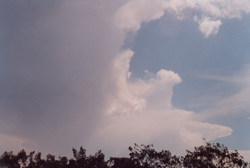
 It seemed to maintain its structure for some time and had gone through the glaciation stage. What was exciting though was that we were looking at the development in the triple point. There was a tower also to the north and it looked quite nice so we aimed for that cell. After all, our cell seemed to not be doing much.
Sunday, 2nd December 2001
Write-up Geoffrey Thurtell
Sunday 2nd
December 2001
Jimmy Deguara's account on the same day
 This day did not look too good except for the development of storms near or north of the border ranges. Anthony Cornelius and Andrew MacDonald had a ball on this event. We observed some explosive updraught towers which they were onto - lucky them. We gave chase but the storms progressively weakened with development further north. So we turned around and headed to Glen Innes for the night.
Monday, 3rd December 2001
Write-up Geoffrey Thurtell
 One disadvantage of travelling between Dorrigo and Bellingen is that as the road goes down the escarpment, the topography and the rainforest combine to make any observation of the weather very difficult. After roadwork delays, we emerged into more open space near Bellingen to see that the storm had weakened considerably as it approached Coffs Harbour. We took some photos of the weakening cell and enjoyed dodging some large raindrops.
Monday 3rd
December 2001
Jimmy Deguara's account on the same day
 We watched from the usual vantage point with intermittent cg's. We finally gave chase but were not able to intercept the storm passing to its south near Bellingen. It was hot and humid with high dewpoints. The northeaster was again blowing indicating just how shallow the moisture layer was.
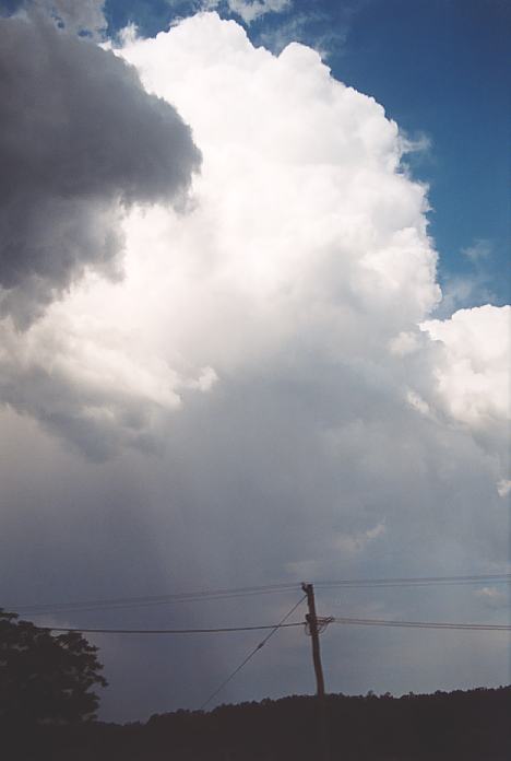 More cells kept developing along the same range where the initial storms had developed. I suspect hail would have been reported from the first storm and some other storms. What amazed me was that the storms were crisp and shallow but maintained for some time. The last one we observed was near Macksville to the south of the Bellingen area. It had backbuilt for about an hour.
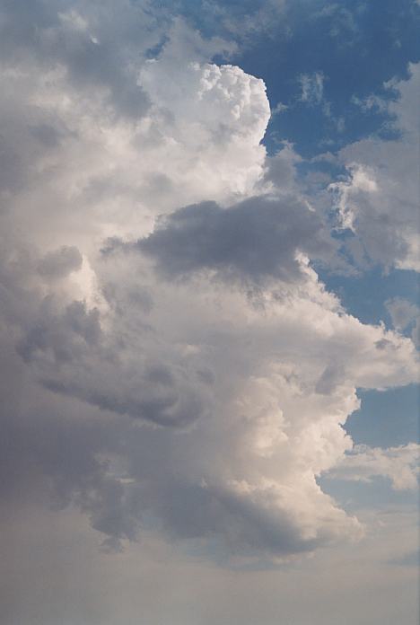
Tuesday, 4th December 2001
Write-up Geoffrey Thurtell
Tuesday 4th
December 2001
Jimmy Deguara's account on the same day
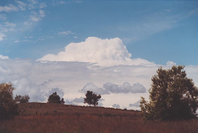
 Cumulus towers were developing and collapsing over the hills near Dorrigo. Finally, one impressive tower broke the cap near the escarpment. It reminded me of the development of the first cell on the 5th November 2000 except the base was a little higher. It towered and glaciated almost overhead. More towers developed behind with this cell weakening just to our northeast.
Wednesday, 5th December 2001
Write-up Geoffrey Thurtell
Document: 200112-05.html
Updated: 27th December, 2002
[Australian Severe Weather index]
[Copyright Notice]
[Email Contacts]
[Search This Site]