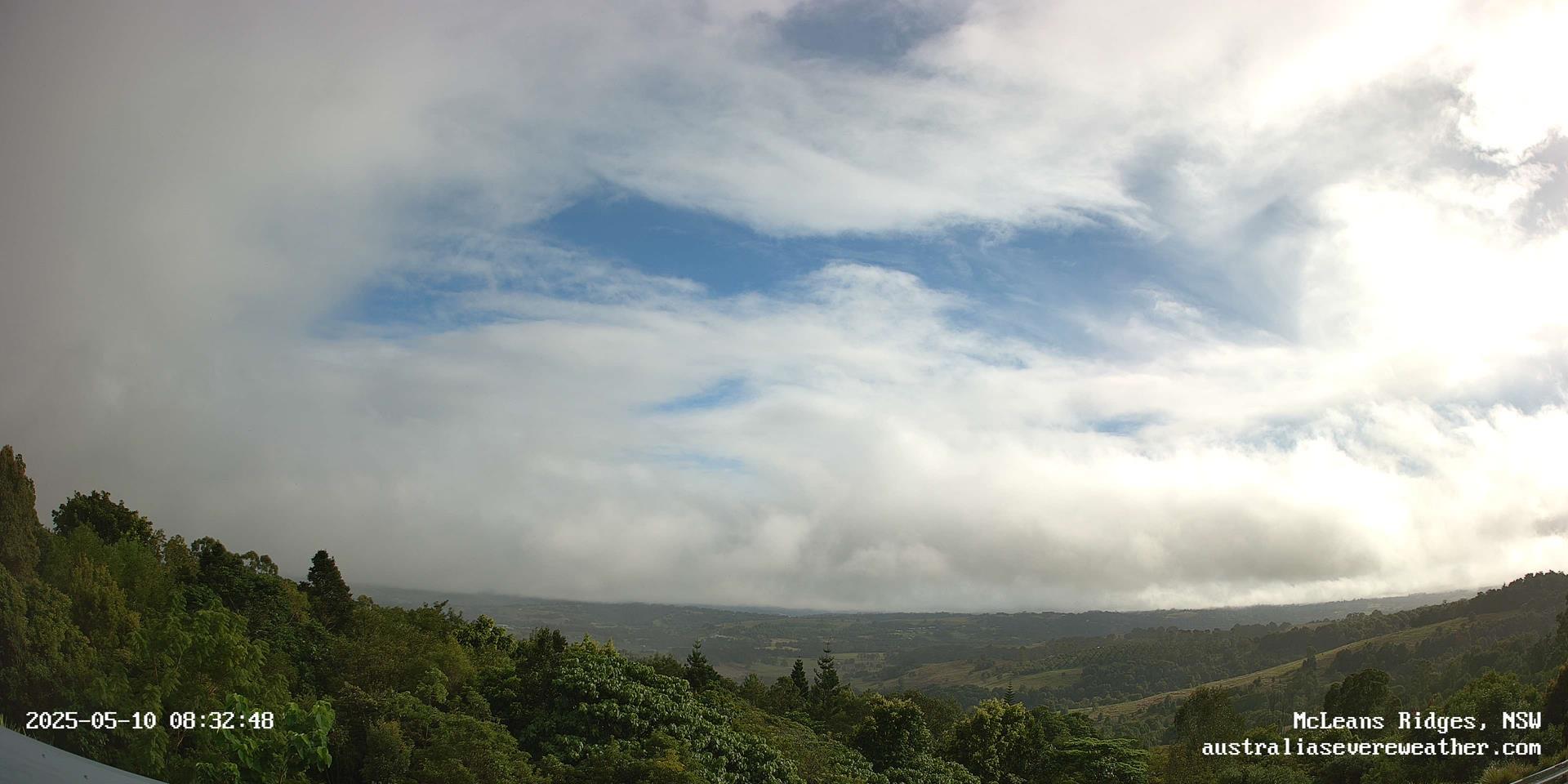
Video Movies
and Stills

[Index][Copyright Notice]
Main Index Home Page Stock Weather Photos Australian Severe Weather Forum Storm News and Storm Chasing Reports Tropical Cyclones / Hurricanes / Typhoons Weather Data and Links Wild Fires / Bushfires Weather Observation Techniques Weather Picture Catalogue Tornado Pictures and Reports Stock Video Footage and DVDs for sale Video Main Index Storm Chase DVDs Weather Webcam and AWS Storm Video Stills Stock Footage Tornado Alley Stock Footage Australia McLeans Ridges Weather Webcam & AWS Search This Site

Advertise on this website


Webcam and AWS Home       Northern View: [Latest Single Image] [Timelapse Animation] [Webcam Archives]
Eastern View: [Latest Single Image] [Timelapse Animation] [Webcam Archives]

 Northwest North   East-Northeast East 
McLeans Ridges Weather Webcam Northern View - click for larger view McLeans Ridges Weather Webcam Eastern View - click for larger view
If an image is shown as broken or out of date, try pressing refresh. Click an image for high resolution weather webcam view.
Current local date/time:
March 2010: East-view camera failing, images unlikely to be available.
Local region radar: [Grafton 128km Scale] [Grafton 256km Scale] [Brisbane 128km Scale] [Brisbane 256km Scale]
Weather Conditions at McLeans Ridges NSW
19:04:50 18 March local time
08:04:50 18 March 2010 UTC
Temperature
Humidity
Dew Point
Base height of Cu cloud
Barometer
Wind Chill
Heat Index
Wind Speed (gust)
Wind Speed (average 1 min)
Rainfall Rate
Rainfall
Rainfall (previous 24 hrs)
+20.6 °C
82 %
+17.4 °C
400 meters. (1312 feet)
1023 hPa and Steady
+21 °C
+24.2 °C
Calm from 196° (S)
Calm from 196° (S)
0 mm/hour
2 mm since 9.00 am
2 mm
The Olympus digital cameras are located at McLeans Ridges, 12km E of Lismore and 9km NW of Alstonville on the North Coast of NSW, Australia. The site is 140 metres above sea level at Lat: 28o 47' 38" S (-28.79), Lon: 153o 23' 54" E (153.40): Google Map location. The Nightcap Range is in the background of the northern view, and the Wilsons River is in the valley foreground. These cameras are operated by Michael Bath and only updated during daylight hours. The eastern facing camera is only active after the sun has risen above its view. Webcam images and AWS data are uploaded every two minutes. Software used to operate the cameras is by Erdman Video Systems.

AWS month-to-date totals and averages are available from the Daily Summary Page. McLeans Ridges is an official Bureau of Meteorology rainfall location: 058023. Monthly and daily rainfall is available online. Past observations from nearby AWS at Ballina, Lismore and Alstonville are available from the BoM. See also the Spring Grove AWS, about 5km northeast of Casino, which provides online weather observations 24/7.

Archived timelapse movies: [Thunderstorms][Weather highlights]
Extreme conditions Since 9.00 am 24 hrs to 9.00 am Since station reset on 1st Jan
Maximum Temperature
Minimum Temperature
Maximum Humidity
Minimum Humidity
Maximum Dew Point
Minimum Dew Point
Maximum Wind (gust)
Maximum Barometric Pressure
Minimum Barometric Pressure
Maximum Rainfall Rate
Total Rain
+27.3 °C at 14:19
+20.5 °C at 09:13
83 % at 09:27
53 % at 11:32
+19.6 °C at 13:14
+15.4 °C at 11:32
16.2 km/h, 64° at 11:58
1025 hPa at 12:52
1023 hPa at 19:04
nil
2 mm
+27.2 °C at 14:54
+16.2 °C at 06:24
83 % at 09:27
55 % at 14:44
+21.3 °C at 12:11
+13.3 °C at 06:00
20.2 km/h, 137° at 17:43
1025 hPa at 08:59
1022 hPa at 18:22
1 mm/hour at 12:16
2 mm
+38.4 °C at 13:22 on 26 January
+15.9 °C at 07:24 on 15 March
94 % at 08:23 on 07 March
19 % at 18:44 on 18 January
 
 
41.4 km/h, 45° at 17:05 on 26 January


411 mm of rain since 09:00 on 01 January

24 Hour Weather Graphs


Weather data content generated by Andy Keir's FreeWX program


Other webcams
  • Kyogle (NSW Northern Rivers)
  • Jiggi (NSW Northern Rivers)
  • Forster (NSW Mid North Coast)
  • Taree (NSW Mid North Coast)
  • Raymond Terrace (NSW Hunter)
  • Various Brisbane and Southeast QLD cameras
  • Jondaryan (QLD Darling Downs)
  • Narrabri and Mt Kaputar (NSW Northwest Slopes and Plains)
  • Inverell and Nullamanna (NSW Northwest Slopes and Plains)

  • Document: webcam.htm
    Updated: 11th March 2010

    eXTReMe Tracker
    [Australian Severe Weather index] [Copyright Notice] [Email Contacts] [Search This Site] [Privacy Policy]